June 29 (UPI) — Tropical Storm Barry was nearing the eastern Gulf Coast of Mexico on Sunday evening, and was expected to bring heavy rains and flash flooding to the North American nation over the next few days.
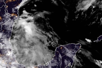
Barry was located about 60 miles southeast of Tampico, on Mexico’s eastern coast, in the Gulf of Mexico, with maximum sustained winds of 45 mph, the National Hurricane Center said in its 7 p.m. CDT update.
It was moving northwest at 8 mph and was on track to make landfall in the next few hours, before moving inland over eastern Mexico Sunday night.
A tropical storm warning is in effect for the Gulf Coast of Mexico from Boca de Catan southward to Tecolutla.
It is not expected to intensify much more before making landfall, and weakening is forecast to begin shortly after it moves inland, according to a NHC discussion on the storm.
“The primary impact with Barry remains heavy rainfall and flash flooding for the upslope areas of eastern Mexico,” the NHC said.
Between 3 and 6 inches of rainfall are expected with isolated maximum totals of 10 inches across the Mexican states of Veracruz, San Luis Potosi and Tamaulipas through Monday, the forecasters said.
“This rainfall may produce life-threatening flooding and mudslides, especially in areas of steep terrain,” it said.
Tropical Storm Barry is the second named storm of the Atlantic hurricane season.
The National Oceanic and Atmospheric Administration is forecasting between 13 and 19 total named storms for this year.