
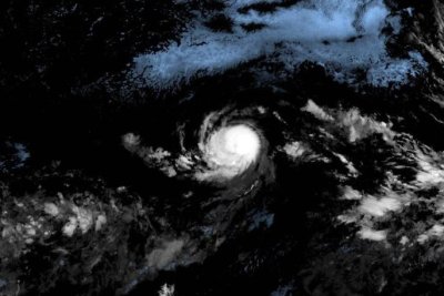
Tropical Storm Kiko (pictured in satellite imagery) strengthened into a hurricane Tuesday. Photo courtesy of National Oceanic and Atmospheric Administration
Sept. 3 (UPI) — Tropical Storm Kiko strengthened into a Category 2 hurricane on Tuesday, according to forecasters who expect it to become a major hurricane in the next day or two.
The storm had maximum sustained winds of 105 mph, the National Hurricane Center said in its 5 p.m. HST update.
It was located about 1,740 miles east of Hilo, Hawaii, and was moving westerly at 7 mph, and was expected to continue moving in that direction along open waters in the eastern Pacific Ocean, the forecasters said.
“The main steering feature continues to be a subtropical ridge located to the north of Kiko,” the NHC said.
“A slow westward motion should continue for the next couple of days,” followed by a “turn toward the west-northwest” in three to four days, the NHC forecast said.
There are no weather watches or warnings in effect because the hurricane is expected to stay over the waters of the Pacific Ocean.
It’s forecast to enter drier air and cooler waters in three or four days, but gain strength until it does. It is expected to remain a hurricane for at least five days.
The storm formed on Sunday, making it the 11th named storm in the Eastern North Pacific this year.