weakens

Imelda weakens to extratropical cyclone after passing Bermuda

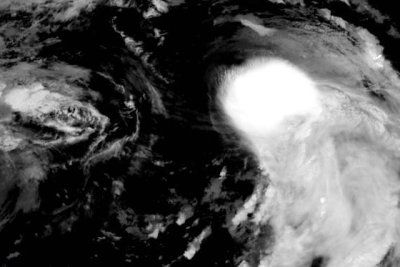
Hurricane Imelda passed over Bermuda overnight. Photo courtesy of NOAA

Oct. 1 (UPI) — The one-time Hurricane Imelda weakened to an extratropical cyclone Thursday after passing over Bermuda, the National Hurricane Center said.

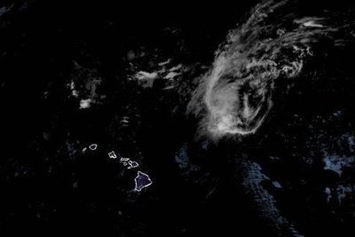
The storm was about 315 miles east-northeast of Bermuda, according to the 11 a.m. EDT update — the last — from the NHC.

Forecasters said Imelda had maximum sustained winds of 75 mph and was moving east-northeast at a rapid 29 mph. The same general motion was expected to continue through Thursday night.

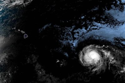
Bermuda has discontinued all tropical storm warnings associated with the storm.

Imelda, the ninth named storm of the 2025 Atlantic hurricane season, is expected to strengthen through Wednesday as it approaches Bermuda and could be a Category 2 storm by the time it nears the island.

Source link

Humberto weakens to Cat. 3 hurricane

Hurricane Humberto is expected to weaken over the next few days. Photo courtesy of the NOAA

Sept. 30 (UPI) — Humberto weakened to a Category 3 storm on Monday in the Atlantic, according to forecasters, who expected it to continue to lose strength over the next few days.

Humberto had maximum sustained winds of 115 mph, the National Hurricane Center said in its 11 p.m. AST update, a drop of 30 mph in the last 12 hours.

It was located about 265 miles southwest of Bermuda and was moving north-northwest at 14 mph, according to forecasters.

Hurricane-force winds extend outward up to 65 miles from the center of the storm, and tropical-force winds extend outward up to 200 miles.

No watches or warnings were in effect.

“On the forecast track, the center of Humberto will pass west and then north of Bermuda on Tuesday and Wednesday,” the NHC said.

Though the storm is expected to continue on its weakening trajectory, it is forecast to become a “strong extratropical system” in the next few days.

Swells generated by Humberto are likely to cause dangerous surf and life-threatening rip current conditions, affecting beaches of the northern Caribbean, Bahamas, Bermuda and much of the U.S. East Coast for the next few days.

Humberto is the eighth named storm of the Atlantic season and became the season’s third hurricane on Friday morning.

On Sunday, it was joined in the Atlantic by Tropical Storm Imelda.

Source link

Hurricane Kiko steadily weakens as it moves toward Hawaii

Hurricane Kiko, shown here off the coast of Hawaii, has been downgraded to a Category 1 storm, and is likely to pass north of the islands. Photo courtesy of NOAA

Sept. 9 (UPI) — Hurricane Kiko was steadily weakening on Monday but remained a Category 1 storm, according to forecasters who predict it will pass north of the Hawaiian Islands in the next two days.

The storm had maximum sustained winds of 75 mph and was located about 300 miles east-northeast of Hilo, Hawaii, and 450 miles east of Honolulu, the National Hurricane Center said in its 5 p.m. HST update.

It was moving northwest at 14 mph, the center said.

On the forecast track, Kiko was expected to pass north of the Hawaiian Islands on Tuesday and Wednesday, the NHC said.

However, swells generated by the storm were gradually building from east to west across Hawaiian waters and are expected to peak Monday night through Wednesday.

“While the risk of direct impacts on the islands continues to decrease, interests should continue to monitor Kiko’s progress and the latest forecasts,” the NHC said in a discussion on the storm

The forecasters said they expect the storm to be downgraded to a tropical storm overnight.

Kiko had intensified to a Category 4 hurricane early last week, but was later downgraded as it weakened off the coast.

No watches or warnings were in place, the NHC said.

Source link

Lorena weakens to tropical storm off Mexican coast; flooding a threat

Tropical Storm Lorena weakened significantly over the past day, but heavy rainfall from the storm could produce flash flooding in Mexico, New Mexico and Arizona. Photo courtesy of National Oceanic and Atmospheric Administration

Sept. 4 (UPI) — Lorena weakened back to tropical storm strength Wednesday after spending about a day as a hurricane off the western Mexican coast, forecasters said.

The storm, which formed early Tuesday, was about 175 miles west of Cabo San Lazaro on the Baja California Peninsula, according to the National Hurricane Center in its 8 p.m. PDT update.

It had maximum sustained winds of 45 mph and was moving northwest at 5 mph.

The Mexican government canceled all watches and warnings associated with Lorena, but the NHC warned that areas in Baja California Sur and Sonora should monitor heavy rainfall across the region.

“This will increase the risk of life-threatening flash floods and mudslides across northwest Mexico,” the NHC said.

Forecasters also called for heavy rainfall in Arizona and New Mexico with flash flooding possible in Arizona.

Lorena, the 12th named storm in the Eastern North Pacific this year, formed as Hurricane Kiko continued to strengthen over the Pacific Ocean.

Source link

Hurricane Kiko weakens to Category 3, heads toward Hawaii

Hurricane Kiko was expected to continue on the path toward the Hawaiian Islands over the next several days, but it’s unclear to what extent it might impact the state. Photo courtesy of National Oceanic and Atmospheric Administration

Sept. 4 (UPI) — Hurricane Kiko weakened to a Category 3 hurricane late Thursday as it made its way northwest toward the general direction of Hawaii, forecasters said.

Kiko had reached Category 4 strength late Wednesday but weakened to 125 mph maximum sustained winds in the National Hurricane Center’s 3 p.m. HST update. Despite the weakening, the storm is still considered a major hurricane that could cause severe damage if it reaches land.

The eye of the storm was located about 1,360 miles east-southeast of Hilo, Hawaii, and 1,565 miles east-southeast of Honolulu. It was traveling west at 9 mph and was expected to continue in that direction and toward the northwest over the next several days.

“Kiko is forecast to approach the Hawaiian Islands during the early to middle portion of next week,” the NHC said in a statement Thursday.

“The risk of direct impacts from wind and rainfall is increasing. However, it is too soon to determine the exact location or magnitude of these impacts, and interests there should continue to monitor the progress of this storm.”

The NHC said swells generated by Kiko could reach the Hawaiian islands toward the end of the weekend, causing life-threatening surf and rip currents.

There were no weather watches or warnings in effect because it was well away from land Thursday.

The storm formed on Sunday, making it the 11th named storm in the Eastern North Pacific this year.

Source link