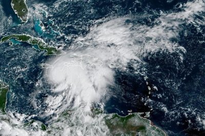
1 of 2 | Tropical Storm Melissa was nearing Caribbean islands. Photo courtesy of NOAA
Oct. 24 (UPI) — Melissa intensified into near-hurricane strength and is forecast to rapidly increase this weekend into a possible Category 5 storm with life-threatening and catastrophic flash flooding and landslides through portions of southern Hispaniola and Jamaica.
Melissa rose to maximum sustained winds of 70 mph and was moving east-southeast at 1 mph, the National Hurricane Center said in its 11 a.m. EDT update. Melisa would be designated as a hurricane with winds of at least 74 mph
Melissa was about 155 miles southeast of Kingston, Jamaica, and about 235 miles southwest of Port-au-Prince, Haiti.
“The exceptionally warm waters, reaching hundreds of feet deep, will act like jet fuel – providing extra energy for Melissa,” AccuWeather Lead Hurricane Expert Alex DaSilva said about Melissa. “The warmest water in the Atlantic basin is in the central Caribbean, in the direct path of this storm. Rapid intensification into a Category 5 hurricane is not out of the question this weekend.”
A hurricane warning was in effect for Jamaica and a hurricane watch for the southwestern peninsula of Haiti from the border with the Dominican Republic to Port-Au-Prince.
“Melissa is still expected to make landfall in Jamaica as an upper-end Category 4 hurricane, which could be the strongest direct landfall for the island in since tropical cyclone record keeping has been made in the Atlantic Basin,” NHC forecaster Philippe said in a discussion.
A turn to the north and northeast is forecast on Monday and Tuesday.
Melissa is forecast to become a hurricane later Saturday and a major hurricane by Sunday.
On the forecast track, Melissa is expected to move near or over Jamaica through early next week, and it could be near or over eastern Cuba by the middle of next week.
“Unfortunately, a large majority of the latest reliable track models show Melissa making landfall on Jamaica in about 72 hours,” NHC forecaster Robbie Berg said. “What’s most concerning here is that the island is likely to experience a couple of days of heavy rainfall and tropical-storm-force winds before the core — and strongest winds — even reach the coast.”
Berg said major hurricane strength is likely when it reaches eastern Cuba “but increased shear should lead to weakening below major hurricane strength by day 5.”
Tropical-force winds stretch outward to 115 mph from the center.
Rainfall of 15 to 25 inches through Sunday is forecast to portions of southern Hispaniola and Jamaica through Tuesday with local maximum 35 inches possible across the Tiburon Peninsula of Haiti, the NHC said.
Eastern Cuba is expected to receive rainfall of 4 to 8 inches, with local amounts up to 12 into Tuesday.
Additional rainfall is likely beyond Tuesday in all the areas, NHC said.
Minor coastal flooding is likely along the south coast of Jamaica later in the weekend or early next week, NHC said. Peak storm surge could reach 5 to 10 feet above ground level near and to the east of where Melissa makes landfall, NHC said.
“This storm surge will be accompanied by large and destructive waves,” NHC said.
Swells are also expected to affect portions of Hispaniola, Jamaica and eastern Cuba during the next several days.
Melissa is the 13th named storm of the season, and it’s the first in the Caribbean.
This season has seen few storms, which have warmed the Caribbean Sea, and the warm water is potential fuel for stronger and more dangerous storms.