There’s an oft-repeated Disneyland creation myth: Artist and animation art director Herb Ryman was given 48 hours to draw an early, heavily detailed and romanticized map of the theme park, which would be used to help sell the project to investors. Although that’s all true, Ryman’s work — one of the most famous and important Disneyland drawings — was far from the first map of Disneyland, as it is often colloquially referred to.
Ryman’s work was in fact an iteration of sorts, based upon years of master planning from Walt Disney and early collaborator Marvin Davis, a cinematic art director responsible for much of Disneyland’s early designs. Some never-before-seen work of Davis and other Disneyland designers will be unearthed in the new book “The Happiest Place On Earth,” from animation producer Don Hahn and theme park designer Christopher Merritt. Both Hahn and Merritt have over the years morphed into theme-park historians, and the book is being released July 15 to coincide with Disneyland’s 70th anniversary.
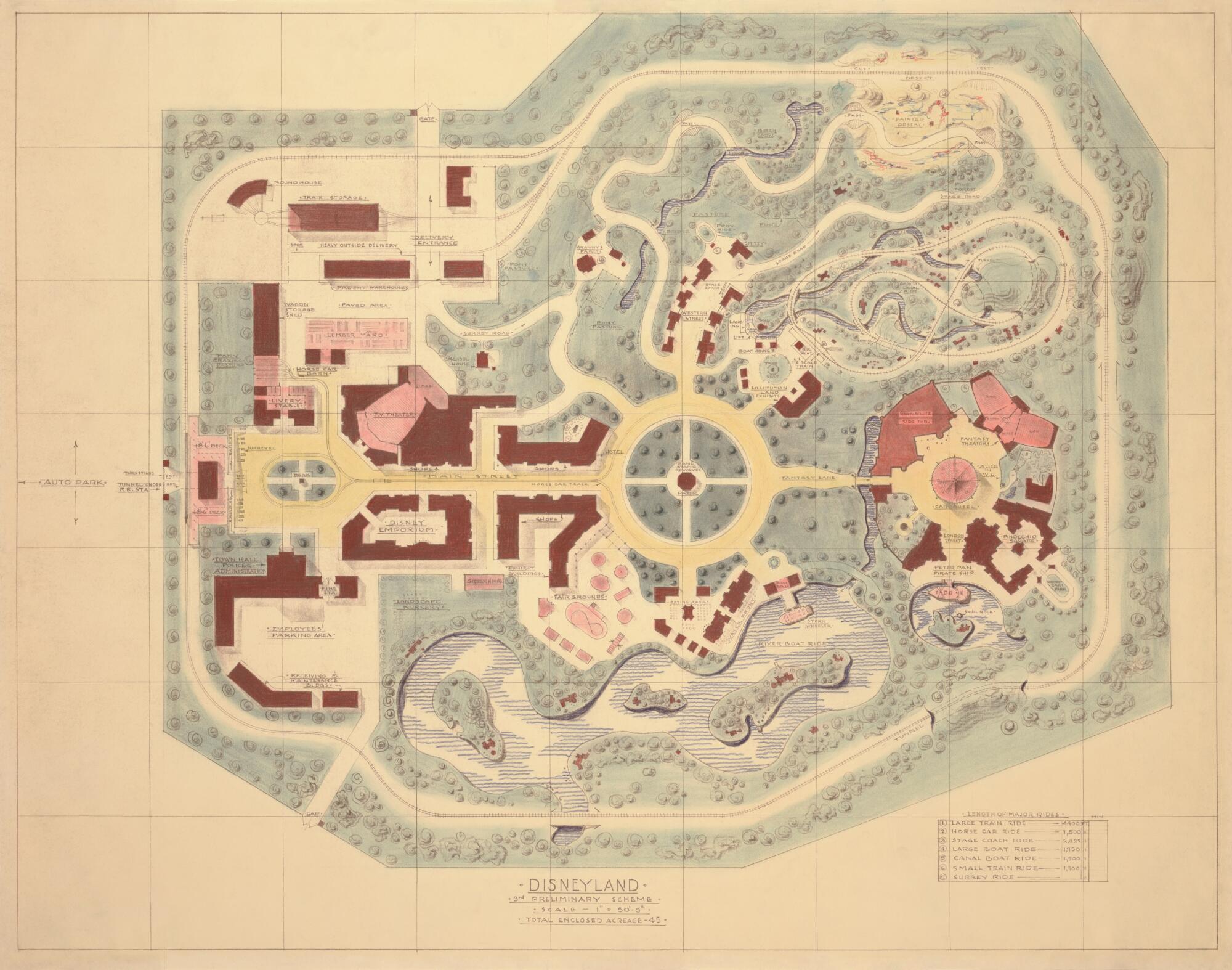
“Marvin Davis claimed that, as he sat there, probably in a room by himself at the studio with Walt standing over him poking him in the shoulder, he did 133 revisions of these maps to get to the Disneyland layout by 1955,” Merritt says. “A few of these maps have been shown before but a lot of these have not been seen before.”

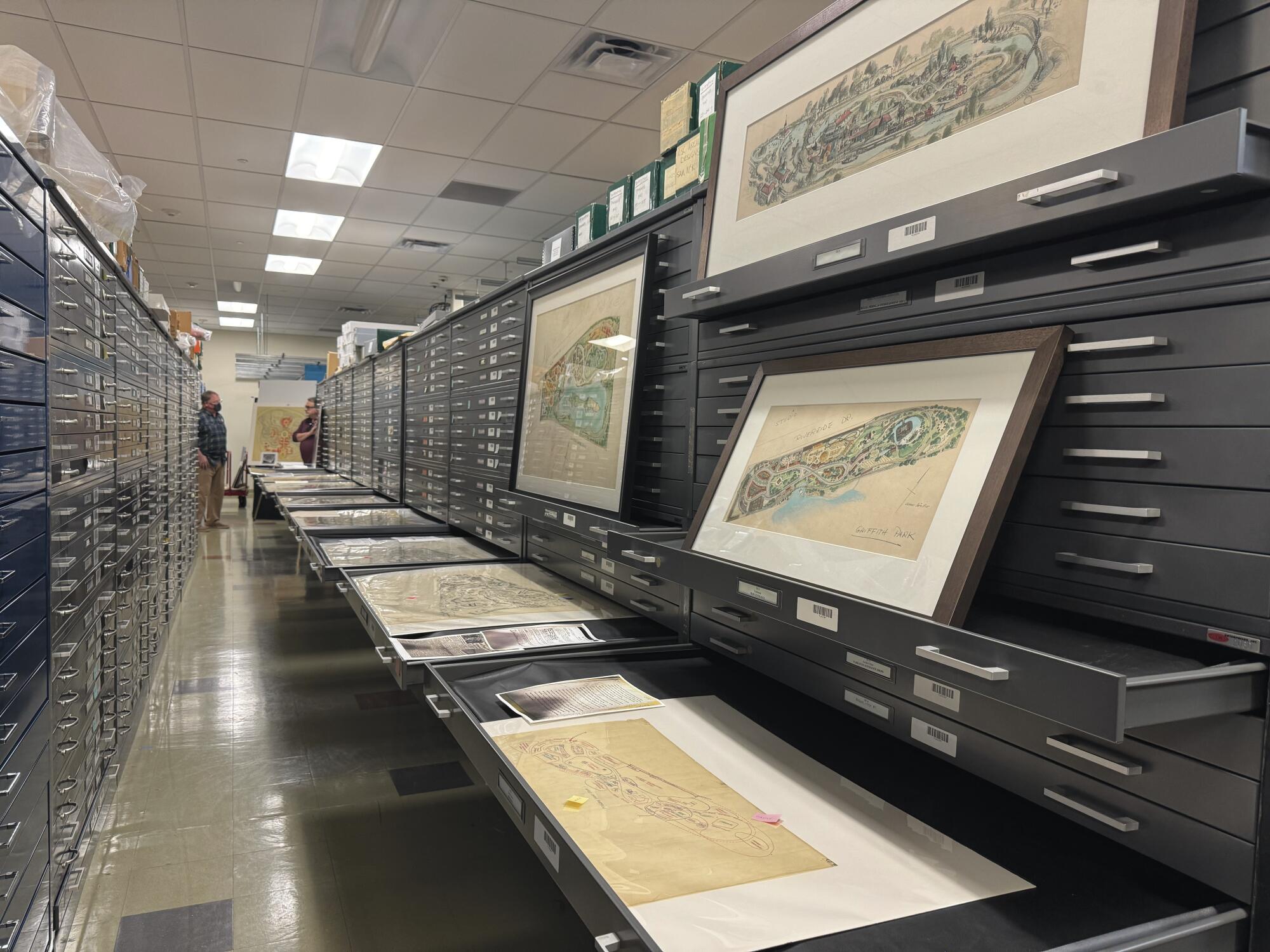
The archives at Walt Disney Imagineering, the secretive division of the company responsible for theme-park experiences. Found in the archives were multiple maps from Marvin Davis that explore Disneyland’s roots.
(Walt Disney Co.)
The book will trace the development of Disneyland, starting in the early ’50s when Disney flirted with the idea of placing the park next to the studio in Burbank — concepts drawn by Harper Goff — to many of Davis’ gradual advancements of the theme-park form. Study them, and they reveal how many of Disneyland’s core ideas were in place by the early 1950s, although they morphed. Alice in Wonderland, for instance, was once envisioned as a walk-through attraction, to be placed across the way from an archery in Fantasyland.
Hahn makes the case that many of the early seeds for Disneyland were planted during a 1948 trip that Disney and animator Ward Kimball took to Chicago. There, the two attended the Chicago Railroad Fair, which had, among its attractions, Abraham Lincoln reenactments and a re-creation of a frontier town.
“His first memo he did when he got home from the Chicago Railroad Fair was all about trying to create these certain regions,” Hahn says. “If you look at the early Burbank parks, there was a western village, there was a stagecoach, there was a railroad station, there was a Tom Sawyer-ish island. A lot of those things came from the Railroad Fair.”
And there was a lot of early experimentation and many a discarded idea. One of Merritt’s favorite rejected concepts was a Tomorrowland exhibition dedicated to hunting for uranium. The attraction has been referenced by Disney and others over the years as a “lost” attraction, but “The Happiest Place on Earth” will feature some never-before-seen concept art from Imagineer Claude Coats.
“Uranium Hunt was an attraction strangely enough to be placed in Tomorrowland, although Claude designed it with Southwestern rock work,” Merritt says. “It was kind of outside rock maze, and the idea was they would hand you Geiger counters, and there was going to be real radioactive uranium embedded in the rock work that you would measure. In the end, they would give you a souvenir uranium to take home with you, which is just crazy-pants.”
Not all of the early Disneyland ideas are as outlandish. What follows are a few of the maps — and some early designs — that led to what would become Disneyland as we know it today.
Early sketches reveal an opera house, general store and more
A Harper Goff-drawn concept for a Disney theme park in Burbank. This is believed to have been drawn in 1951.
(Walt Disney Co.)
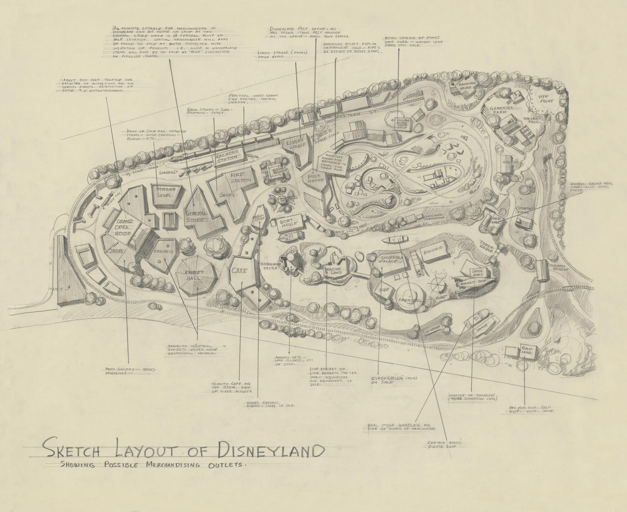
An early 1950s sketch layout of Disneyland, focusing on merchandising outlets.
(Walt Disney Co.)
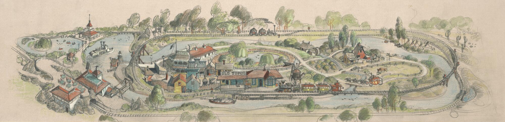
Disney first considered a theme park across from its studios in Burbank, land that is today occupied by Walt Disney Animation Studios and the West Coast headquarters of ABC. The idea, in its early conceptions, included much of what would later make its way to Disneyland — a train, a steamboat and less detailed versions of Main Street and a Frontierland.
Of particular note here is the second photo, unearthed in “The Happiest Place on Earth” for the first time. The focus is on merchandising locations, but those who study the image will spy an opera house and a general store, believed to be the first time such concepts appear. There’s also a spaceport, a haunted house and a re-creation of London’s Tower Bridge. Shops are said to be themed to properties such as “Cinderella” and “Pinocchio.”
“It shows the holistic thinking, too, of not just the attractions but commerce,” Hahn says. “Where the stores would be, where the cafes would be, and kind of a guest-experience mentality. That was a real theme-park innovation, where you’re transported in time to Frontierland but the food and the costumes add up to Frontierland as well. You see the beginnings of that in a map like this.”
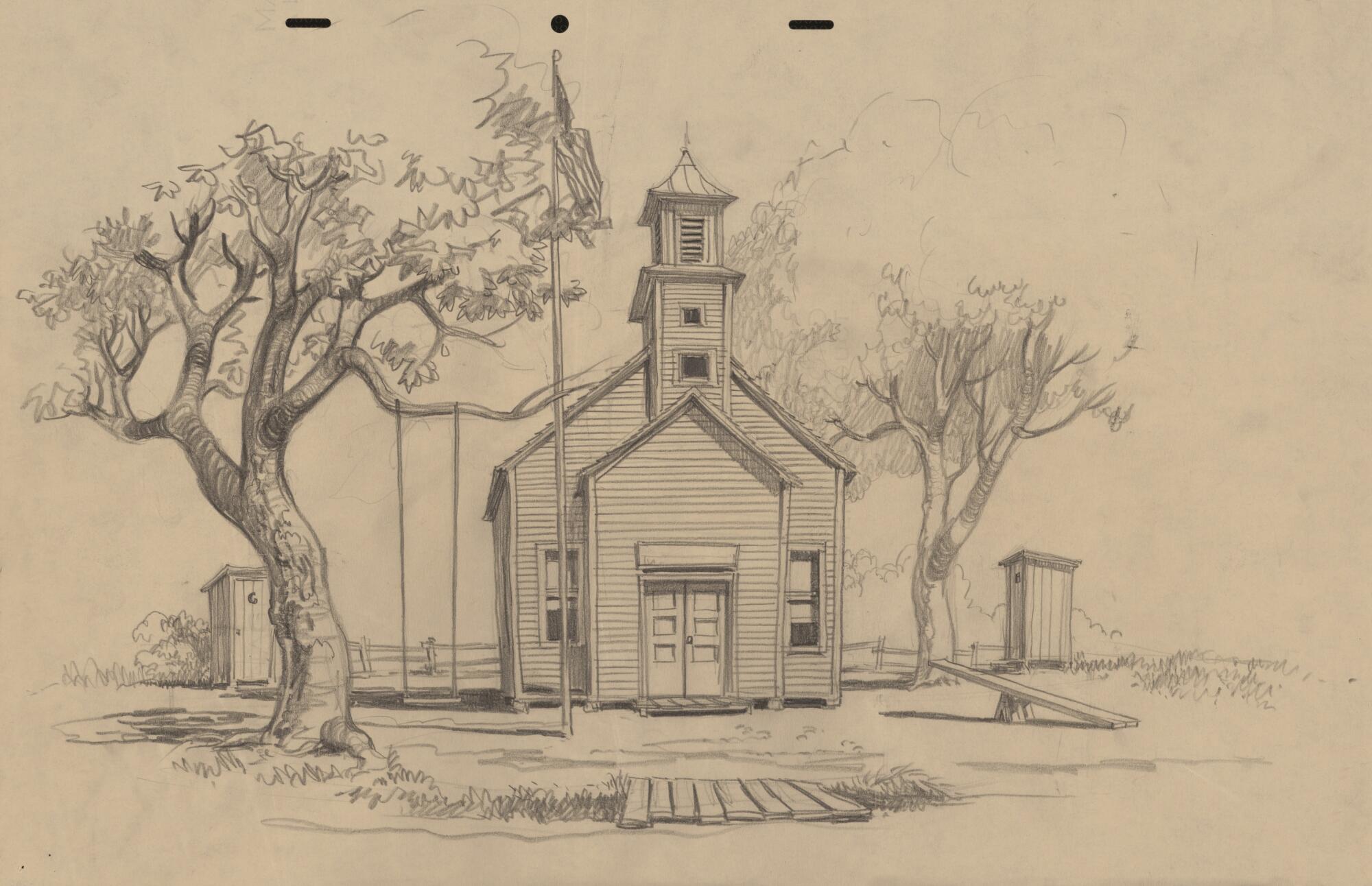
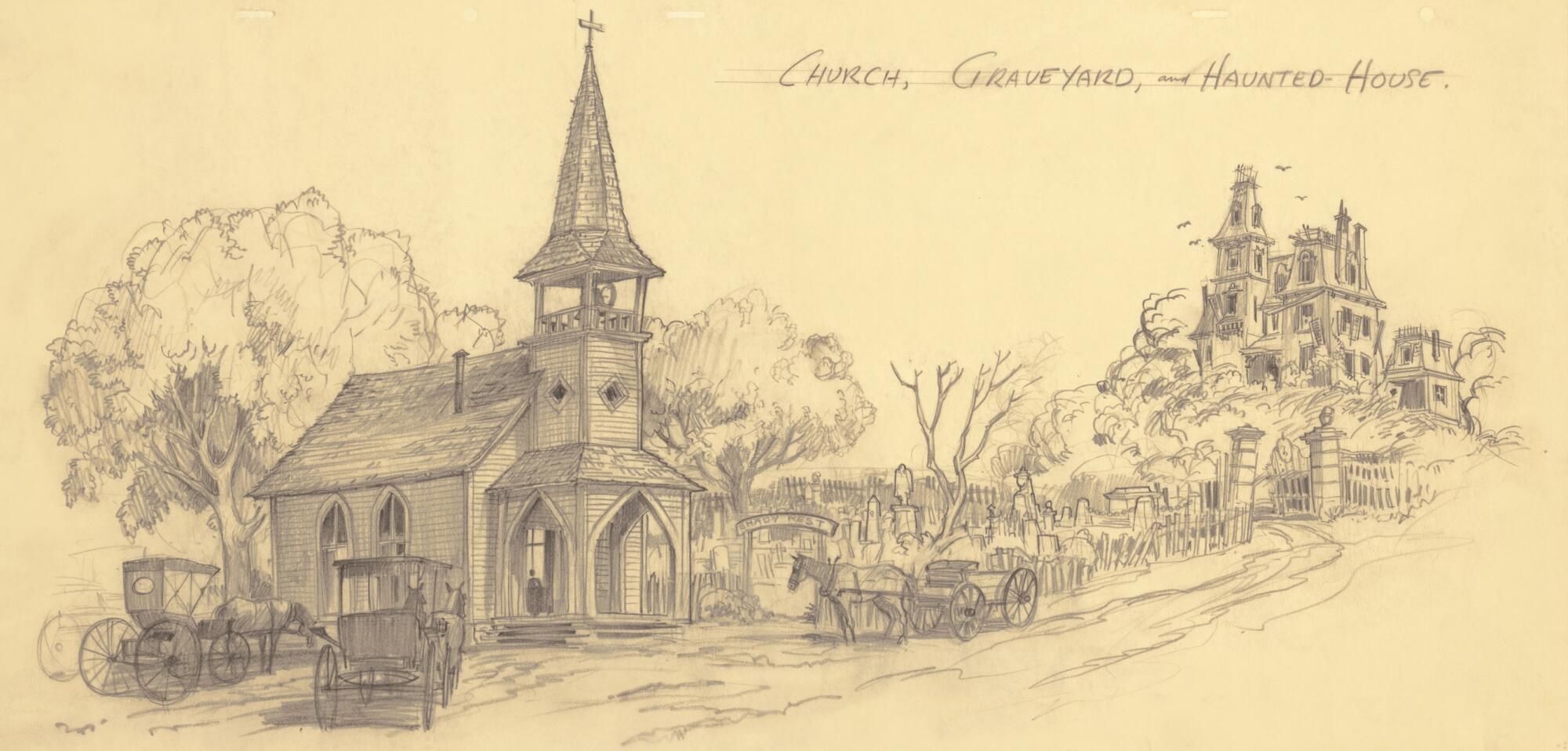
The beginnings of Frontierland and the Storybook Land Canal Boats
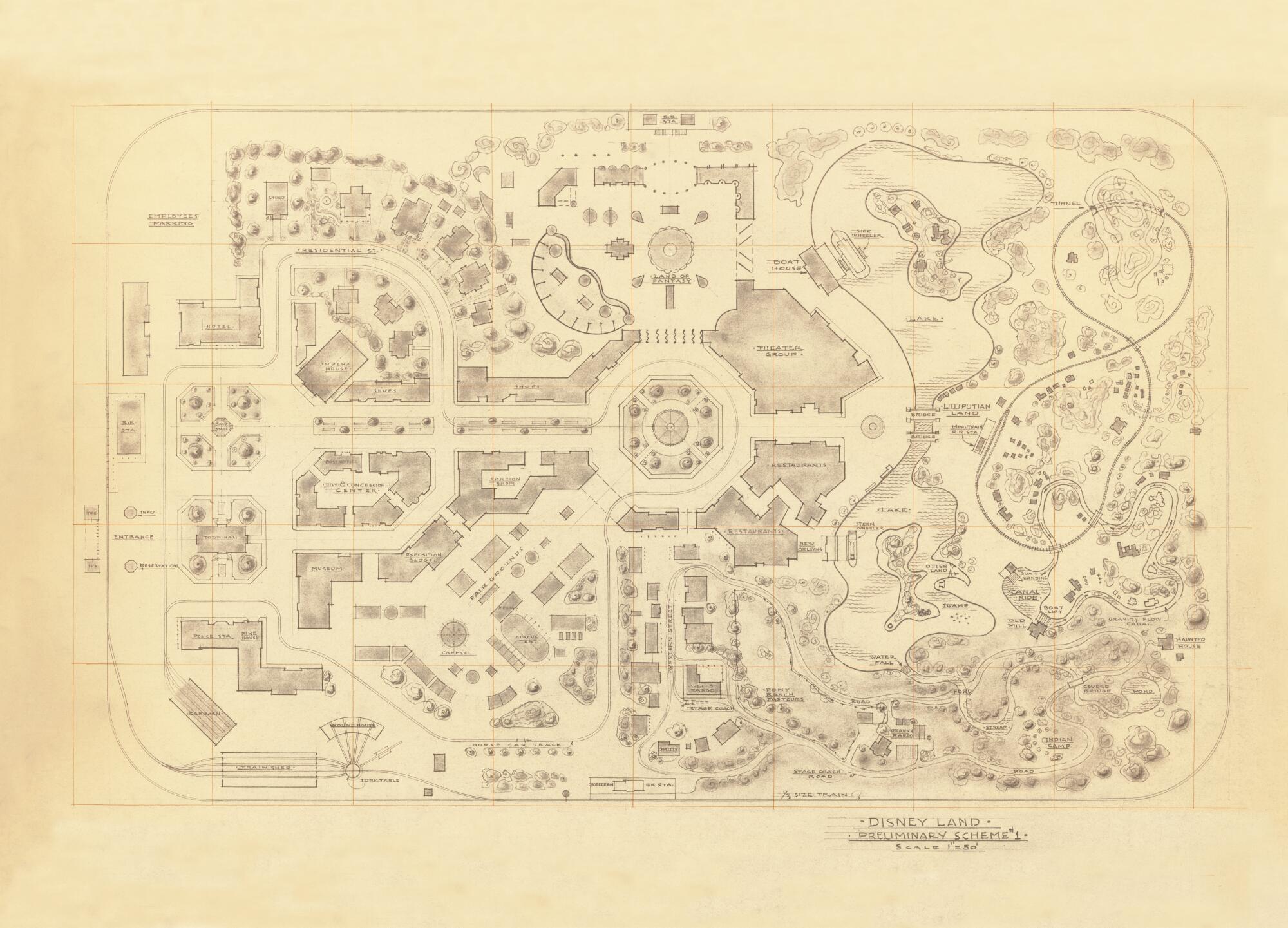
An early Disneyland map drawn by Marvin Davis. This map was likely drawn around 1953.
(Walt Disney Co.)
These early Disneyland schematics from Davis begin to capture Disneyland’s “hub” idea, that is, a central area that leads to and from its themed spaces. There’s a large theater space, believed to be designed in the hopes of Disneyland becoming a television production locale, and a significant plot dedicated to a river with surrounding attractions — the map calls for a space for otters, as well as a swamp area.
The Frontierland concept is still present, complete with a pony ranch and a stagecoach, as is a haunted house and a land themed to miniatures, a concept that would ultimately become the Storybook Land Canal Boats. Merritt notes that this design is location-agnostic, as Anaheim had not yet been decided upon for Disneyland.
Of particular note here is an introductory land like a Main Street, U.S.A., leading to a central hub. “These maps are revelatory when you look at them all in sequence,” Merritt says.
Davis’ early maps also highlight a residential street with large Victorian homes. The second image, in particular, mentions a town hall and a church. Hahn and Merritt believe this land was heavily influenced by the look and tone of “Lady and the Tramp.”
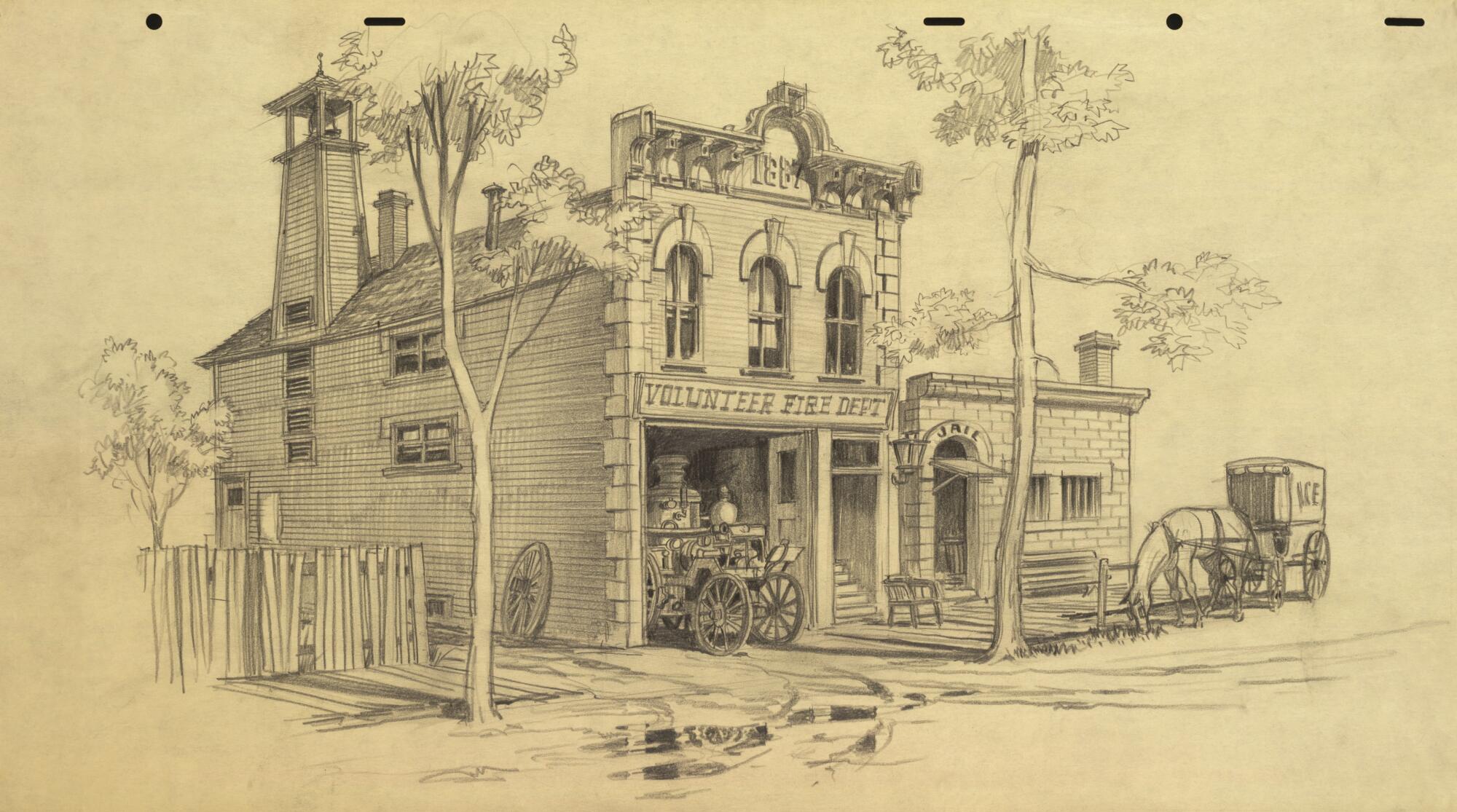
Main Street starts to materialize
An early Harper Goff design that influenced the look of Frontierland.
(Walt Disney Co.)
Some early Harper Goff designs for what would become Disneyland.
(Walt Disney Co.)
Early Disneyland concept art from Harper Goff
(Walt Disney Co.)
These, says Merritt, are a selection 1951 drawings from Harper Goff. The work is exploratory, in that it could have been envisioned for multiple parts of the park. While Goff’s impact on Frontierland is well documented — and Hahn notes, perhaps, an influence from Knott’s Berry Farm’s Ghost Town in these images — it’s also believed some of these designs were kicked around as a potential Main Street, U.S.A., concept.
Main Street, says Hahn, is often noted as being largely influenced by Disney’s time as a child in Marceline, Mo. While that isn’t really doubted these days among Disney’s fan base, Hahn says that theory wasn’t arrived upon immediately. He notes that some of Goff’s early concept work has a slight Victorian bent, which Goff drew from both “Lady and the Tramp” and his own childhood.
“It’s really the childhood of nobody,” Hahn says of Main Street. “It’s an idealized America. Goff grew up in Colorado, and a lot of these are his Victorian memories of his Colorado hometown. These are set designers who were bringing their movie chops to Disneyland.”
Welcome to the park’s destination: Anaheim
A pivotal early Disneyland map drawn by Marvin Davis.
(Walt Disney Co. )
Merritt and Hahn believe this third early schematic of Disneyland from Davis — the drawing is undated — is perhaps the first to envision Anaheim as the park’s destination. The image needs only to be rotated and one can see many of the pieces that would comprise the park — a Main Street, a central hub and, for the first time since Goff’s drawings of the Burbank park, a train that encircles the grounds.
Zoom in, and one will see there’s a large “emporium” to greet guests — and shoppers — on Main Street, U.S.A., as well as a castle-like moat to mark the entrance to Fantasyland. Still present are TV production spaces at the front of the park, and the map lists a host of attractions, including a horse-drawn carriage, train rides and boat rides.
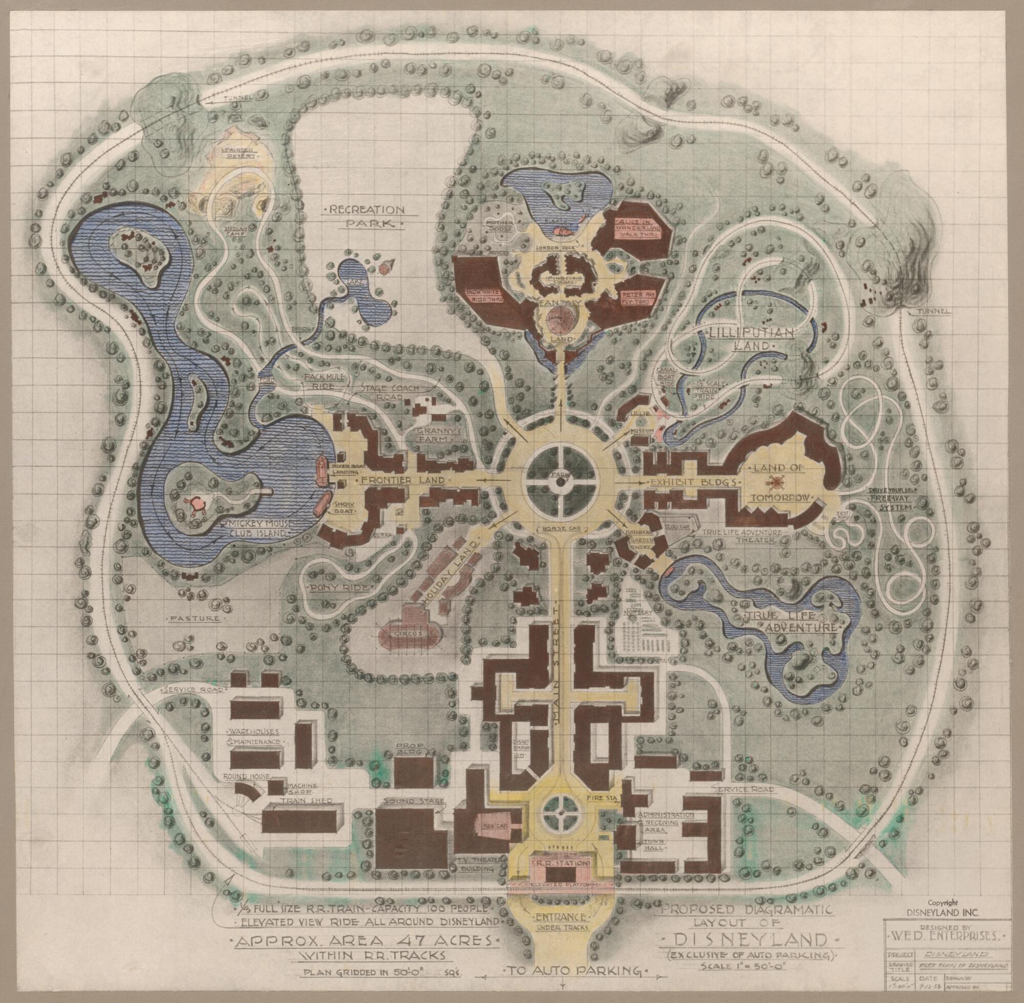
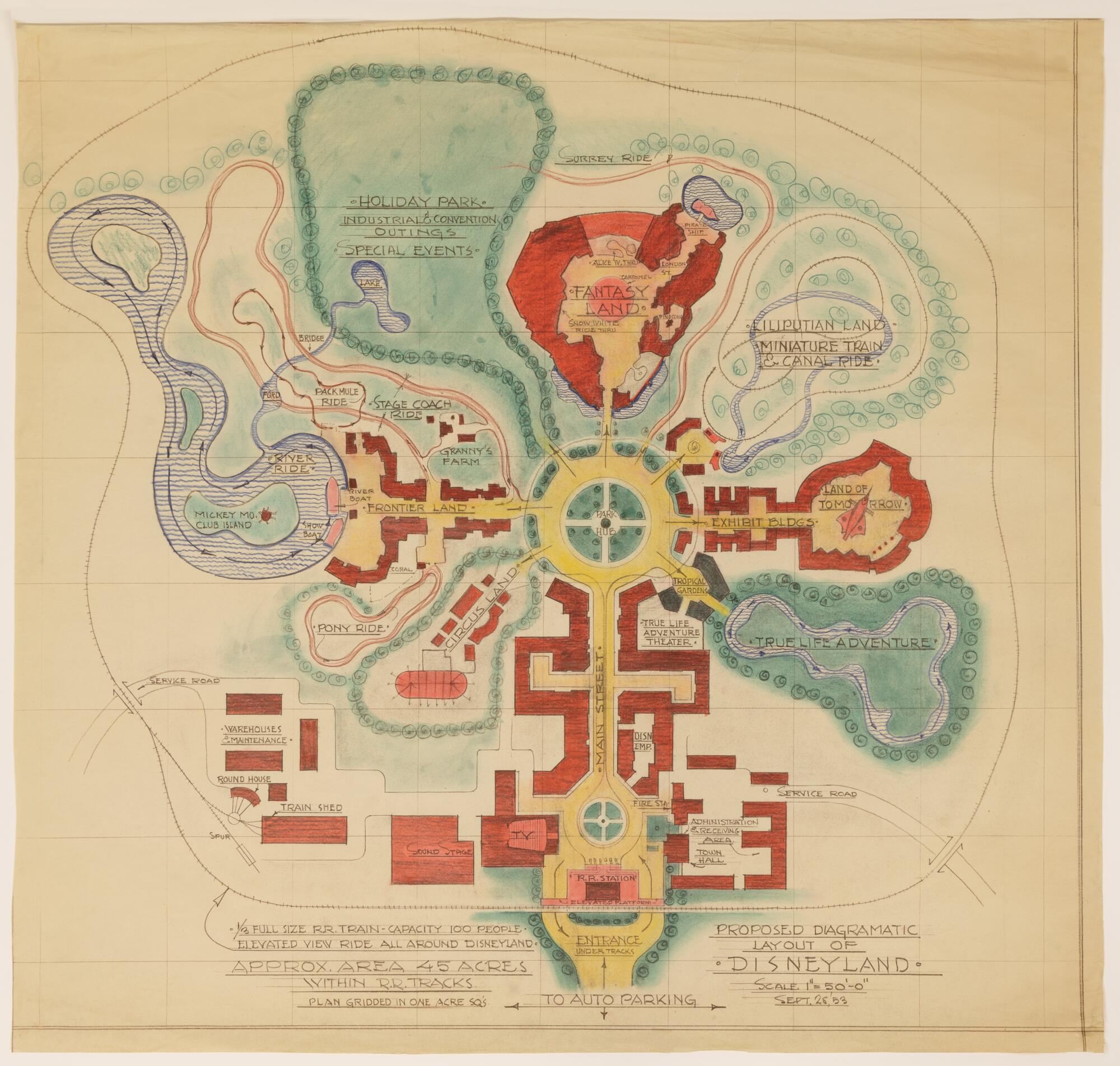
Maps begin to show the Disneyland attractions we know today
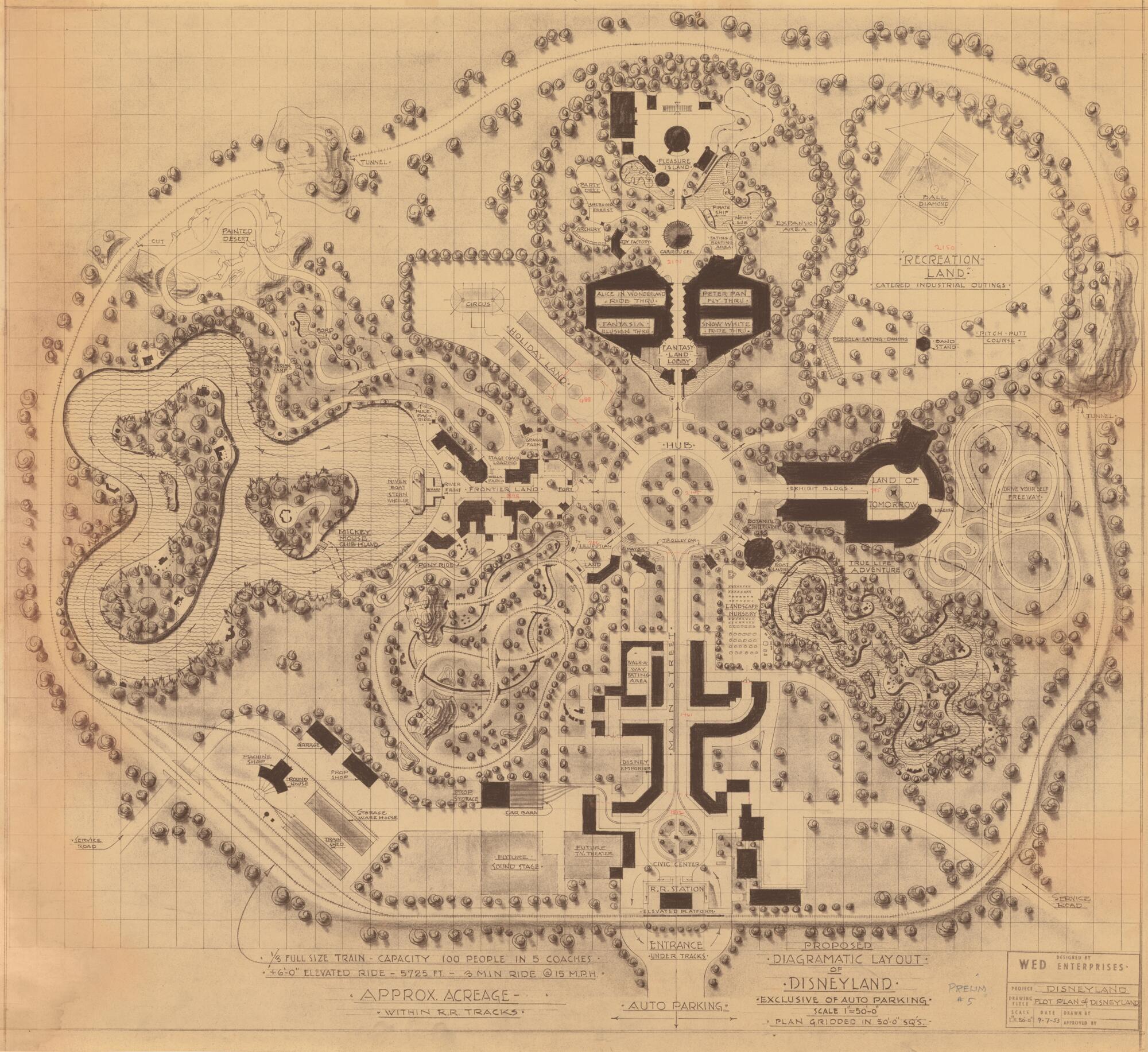
A fall 1953 map of Disneyland from Marvin Davis.
(Walt Disney Co.)
A September 1953 map of Disneyland from Marvin Davis.
(Walt Disney Co.)
A September 1953 map of Disneyland from Marvin Davis.
(Walt Disney Co.)
These three Davis maps are from September 1953, made just days apart. The bottom drawing is a bit more simplified, as it was designed to be shown to TV networks and financiers. One can see a ride inspired by Disney’s “True-Life Adventures” on the right side of the park. This would ultimately become the Jungle Cruise and be flipped to the left side of the park.
All three maps, however, were instrumental in the final design of Disneyland, envisioning Anaheim as the ultimate destination. Of note in the middle image is a Recreation Land, home to a ball field, a mini-golf course and a bandstand. At this time, Disneyland was still envisioned as housing a circus, a concept that was explored in the actual park after opening but soon discarded. Yet Fantasyland, a Land of Tomorrow, Frontierland and what would become Adventureland are all present.
Fantasyland is home in these drawings to attractions themed to “Snow White and the Seven Dwarfs,” “Peter Pan,” “Alice in Wonderland,” Pinocchio” (denoted as Pleasure Island) and “Fantasia.” Also present is what would become Autopia, signifying that Disneyland in late 1953 had many of its early attractions solidified. Still, many, such as a Mother Goose area, would pop-up and then disappear from the maps.
Says Merritt, “You’re going to want to get your magnifying glass to look at some of this stuff.”