
Many of the treks to reach the San Gabriel Mountains’ highest peaks are arduous slogs up steep hillsides, all-day affairs that, while rewarding, are not simple day hikes.
But then there’s Throop Peak (pronounced “troop”).
Reachable via a four-mile, round-trip hike over moderate terrain, this 9,138-foot summit offers panoramic views of Los Angeles County and beyond, with some hikers reportedly seeing not only the Pacific Ocean but also Death Valley from this mountaintop.
Newsletter
You are reading The Wild newsletter
Sign up to get expert tips on the best of Southern California’s beaches, trails, parks, deserts, forests and mountains in your inbox every Thursday
You may occasionally receive promotional content from the Los Angeles Times.
A few reminders before we dive in:
- Always check the weather before leaving, especially right now when L.A.’s weather patterns are flip-flopping between autumnal 🍂 and summer. 🥵
- Pack more water than you think you need; there is none on this trail (although Little Jimmy and Lamel Springs — seasonal water options — are nearby).
- Print this form, place it on your vehicle’s dash and remember to share a digital copy with a loved one before you leave.
A view of Mount Lewis and the Antelope Valley from the trail near Throop Peak.
(Jaclyn Cosgrove / Los Angeles Times)
You’ll start your trek to Throop Peak at Dawson Saddle, a mountain pass that’s about an hour-and-a-half northeast of downtown L.A. There are no toilets at the trailhead, so make sure to stop beforehand if needed, perhaps at the nearby Jarvi Vista Overlook, which you’ll pass if you’re taking Angeles Crest Highway to reach the trail.
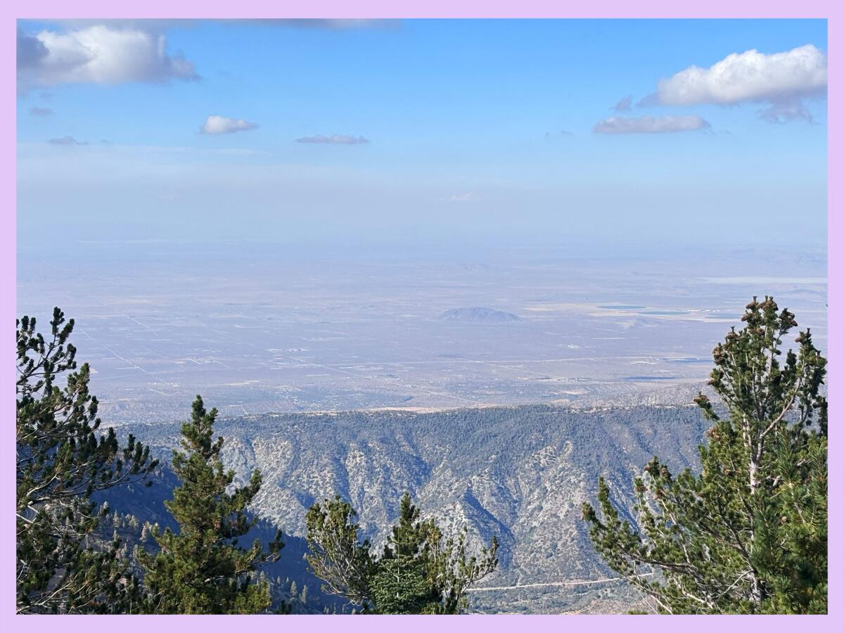
A view of the Antelope Valley, including Three Sisters and Black Butte, from the Dawson Saddle trail.
(Jaclyn Cosgrove / Los Angeles Times)
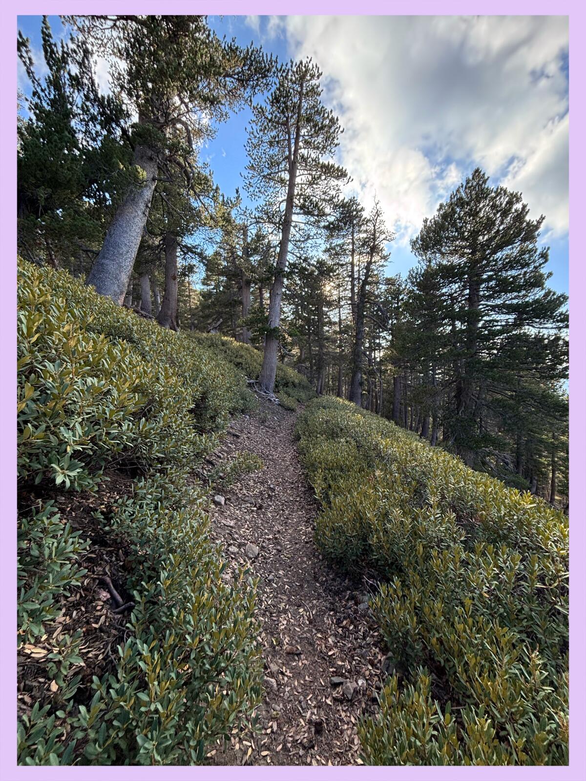
You’ll find the trailhead across the highway from a large maintenance shed. Please take good care as you head up the first third of a mile of the trail, which is narrow and slippery. Hiking poles would be helpful here.
Need to catch your breath as you get acclimated? Turn and appreciate the immediate views of the Antelope Valley to the north!
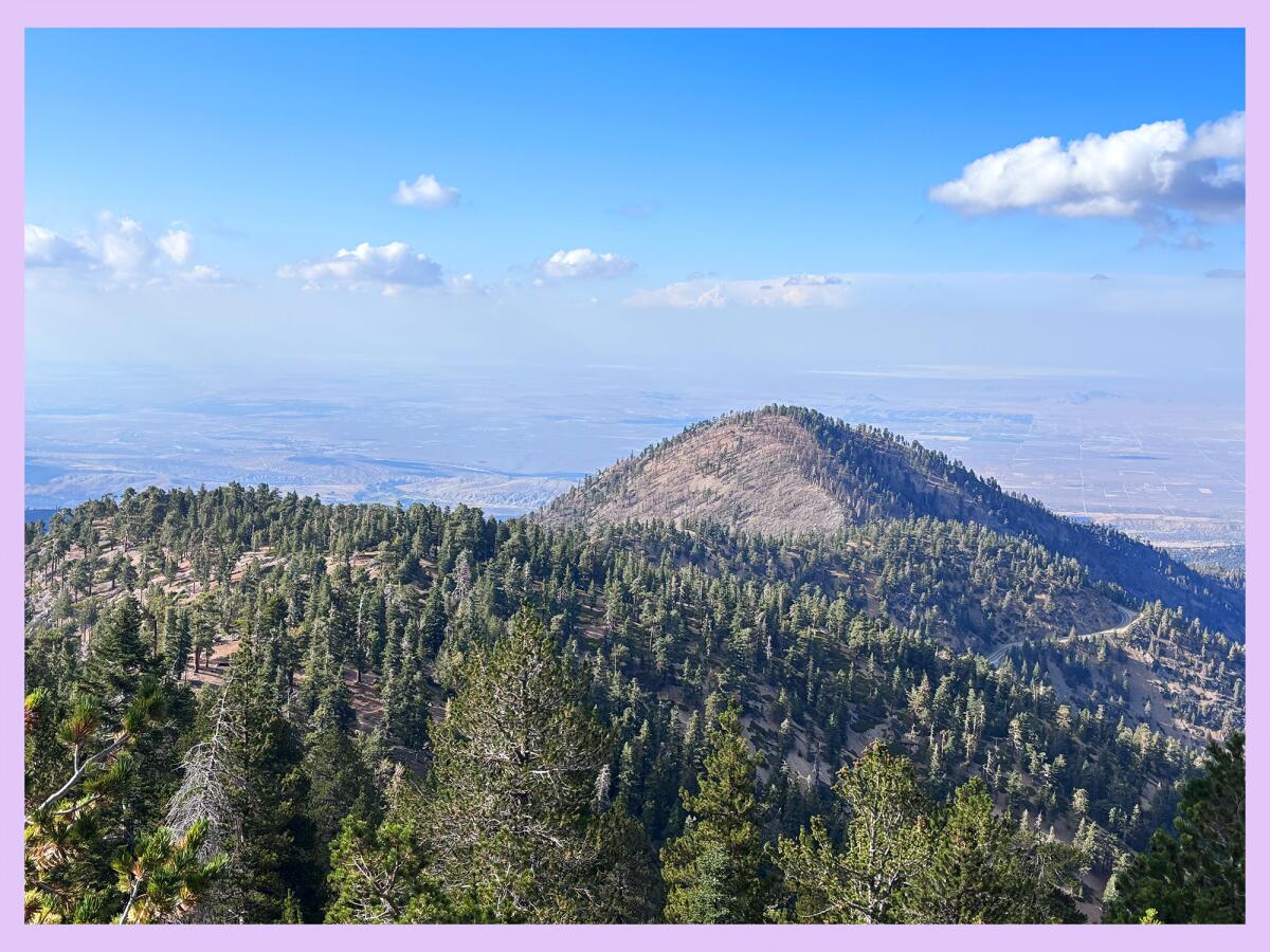
Soon, you’ll reach a ridgeline that you’ll take south past fallen logs, green pine trees and thick manzanita. From here, about half a mile in, you can look to the southeast and see where you’re headed. Throop Peak will be already visible! The trail is fairly moderate from here.
The trail to Throop Peak includes a lush segment through pine forest.
(Jaclyn Cosgrove / Los Angeles Times)
About 1.25 miles in, you will notice on your map that you can take one of two paths to reach the summit.
Mostly out of curiosity, I took the more direct route: a third of a mile up steep terrain where I crushed over sandy, rocky soil that at times was unstable. I wished I had trekking poles, but in what seems to be my curse, I forgot them at home (again!).
Just before reaching the summit, I followed the path through a thick stand of manzanita. I crossed through, although doing so always gives me the willies because snakes love shady shrubs.
The other path to the summit is twice as long, but only two-thirds of a mile, so still a short jaunt. With either path, you will gain just over 460 feet in elevation, and either path will reward you with increasingly stunning views.
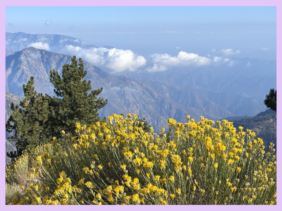
I was blown away when I reached the summit, quickly noticing nearby Mt. Baden Powell, which I’ve hiked many times. Farther out, I observed layers of mountains seemingly stacked against each other, like views a painter using aerial or atmospheric perspective employs to show depth.
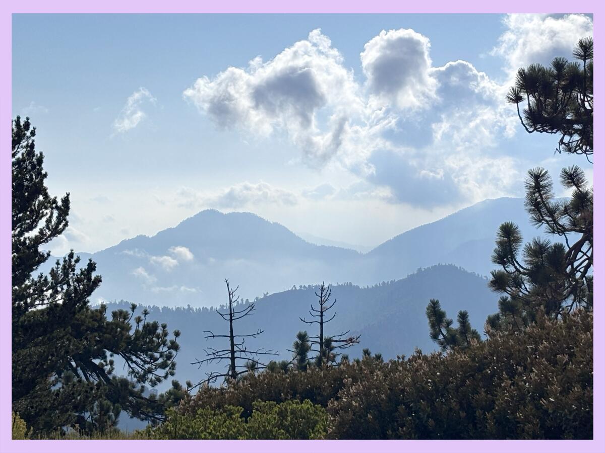
Layers of peaks visible from the Throop Peak summit.
(Jaclyn Cosgrove / Los Angeles Times)
I read the plaque at the summit that identifies its namesake, Amos G. Throop, founder of “Throop University in 1891,” which eventually became CalTech. (For transparency, Throop founded a Universalist group in Pasadena that exists now as the church I attend; hence I knew how to pronounce the peak’s name.)
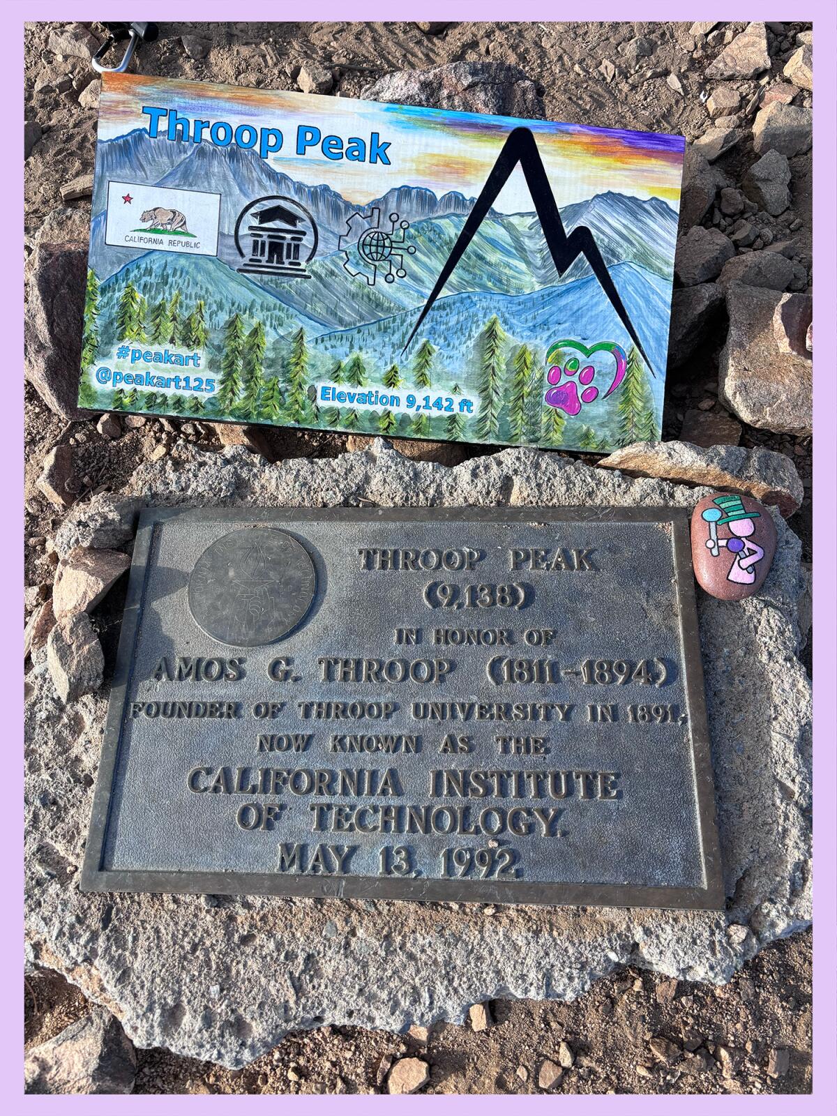
The official and unofficial signs that mark the summit of Throop Peak.
(Jaclyn Cosgrove / Los Angeles Times)
One of the nice parts of this hike is that it isn’t terribly crowded. I encountered only five people and three dogs on my late afternoon hike last week. I had the summit to myself, which meant I could sit and really appreciate not only the surrounding vistas but also its native plants, including thick patches of yellow rabbitbrush, some lupine and maybe a bit of San Bernardino beardtongue, if my plant identification app is correct.
If you’d like to continue hiking, you have the option — as long as you have a good map — to keep hiking, hitting Mt. Baden Powell, Mt. Hawkins or any number of other surrounding peaks.
On my way down, I listened to two Clark’s nutcrackers calling back and forth to each other, and then later, the echoing squawks of ravens communicating as they foraged together.
The view from Throop Peak, a less popular hike in Angeles National Forest.
(Jaclyn Cosgrove / Los Angeles Times)
Given its short distance, moderate difficulty level and high payoff, this is one of my new favorite hikes. I’d like to return soon with friends to watch the moon rise from the summit, as the clear views to the east offer excellent opportunity for that. With every new adventure comes inspiration for the next one. May you find the same!
Throop Peak via Dawson Saddle
Distance: 4 miles
Elevation gained: About 1,200 feet
Difficulty: Moderate
Dogs allowed? Yes
Accessible alternative: For desert vibes, the Prime Desert Woodland Preserve; for views, Mount Wilson Observatory

3 things to do
Beachgoers enjoying the sun at Bluebird beach.
(Jacqueline Pinedo / Los Angeles Times)
1. Hunt for “trashure” along L.A’s coastline
The California Coastal Commission’s annual coastal cleanup day will be from 9 a.m. to noon Saturday, with cleanup events across the coastline. Several volunteer events are scheduled in L.A. County from Malibu to Long Beach. This year, volunteers can participate in what the commission has dubbed the “world’s largest scavenger hunt.” Various “trashure,” which can be redeemed for prizes including hotel stays, sporting event tickets and gift cards, will be hidden at cleanup sites. Learn more and sign up at coastal.ca.gov.
2. Begin your birding journey in Huntington Beach
Bolsa Chica Conservancy in Huntington Beach will host a beginner birder workshop from 9 a.m. to noon Sunday at its interpretative center (3842 Warner Ave.). Participants will learn how to use binoculars and how to spot and identify local birds. The class is $20 per person. Space is limited. Sign up at bolsachica.org.
3. Hike near herons in Harbor City
Los Angeles City Department of Recreation and Parks will host a nature hike from 8 to 10 a.m. Saturday through Ken Malloy Harbor Regional Park in Harbor City. Ryan Kinzel, the park department’s junior urban ecologist, will guide participants on this free trek near Machado Lake, home to more than 300 species of migratory birds, including multiple species of herons. Register at eventbrite.com, although walkups are welcome.

The must-read
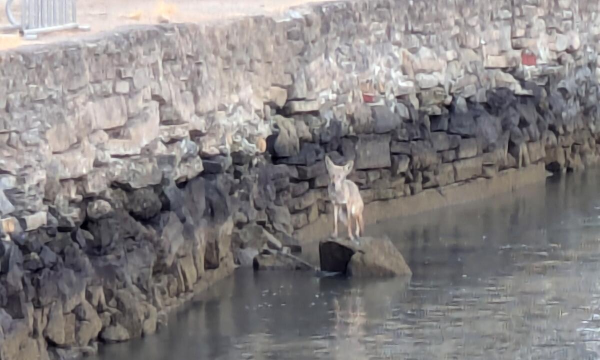
A coyote at Ayala Cove located on Angel Island, a state park in the San Francisco Bay Area, on Aug. 29.
(California State Parks)
At first, the dog-like creature swimming through the San Francisco Bay looked to be a seal or sea lion. Times staff writer Alex Wigglesworth reported that onlookers, including seasoned wildlife scientists, were amazed to discover that it was instead a coyote, swimming a quarter mile off the coast of Angel Island. Coyotes have lived at Angel Island State Park since 2017, when scientists observed the first one to arrive. That ’yote may have howled enough pleas for companionship across the bay to entice more to join it. Brett Furnas, an environmental scientist with the California Department of Fish and Wildlife, pointed out that the coyote recently spotted was swimming away from the island. “That’s consistent with dispersal,” he said. “I think some of those coyotes are now saying, ‘Hey, we want our own territory,’ and they’re trying to swim back to Marin.”
Happy adventuring,

P.S.
Our local parks are for everyone. That’s why it’s so important that as many residents as possible weigh in on the city of Los Angeles Park Needs Assessment. Is your community in dire need of green spaces? Does your local park need better lighting? What’s missing? What’s your dream for your neighborhood park? You can submit your comments at needs.parks.lacity.gov to help shape the future of our green spaces and more. On the website, you can also learn about when the next community meeting is scheduled near you.
For more insider tips on Southern California’s beaches, trails and parks, check out past editions of The Wild. And to view this newsletter in your browser, click here.