thunderstorms

Amber warning as thunderstorms set to bring flash floods

Tomasz Schafernaker

BBC meteorologist

Getty Images Woman walking in heavy rain holding a jacket over her head.Getty Images

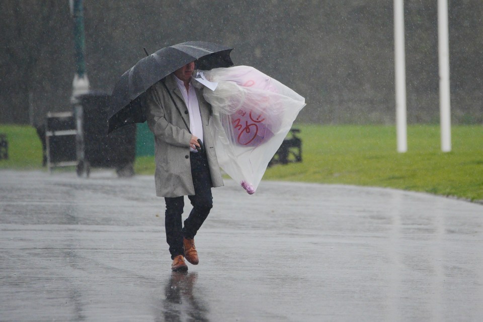
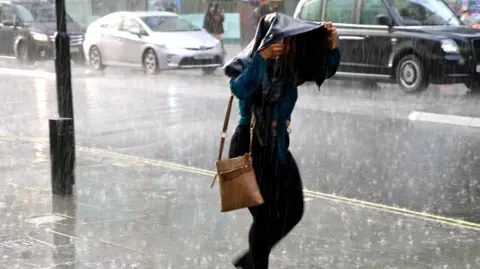
Parts of the UK are bracing for potentially dangerous flash flooding as thunderstorms and torrential rain are set to arrive over the weekend.

An amber weather warning came into effect on Saturday morning, when more than a month’s worth of rain is forecast to fall in a matter of hours.

The Met Office says fast-flowing and deep floodwaters are likely, leading to road and transport disruption, as well as power cuts.

The warning for torrential downpours comes days after a third UK heatwave of the year that parched swathes of the UK and led to several hosepipe bans being declared.

This will make flooding more likely and severe as the dry ground will not be able to absorb as much water.

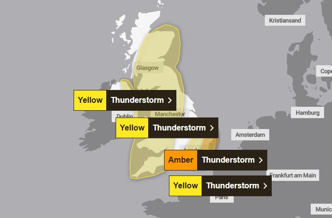
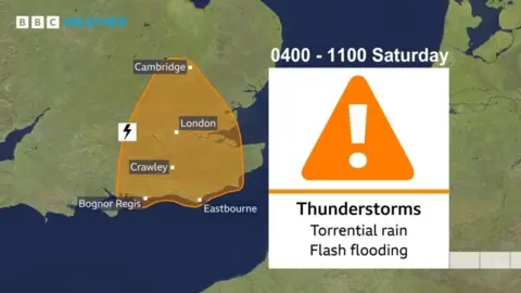
The amber warning covers a stretch of the south coast, London and Cambridge, and is in force from 04:00 BST to 11:00 on Saturday.

Between 20 and 40mm of rain could fall within an hour in this area, the Met Office has warned, which could accumulate to 70-100mm in just a few hours.

It said homes and businesses are likely to be flooded, which will happen “quickly”, while this amount of surface water will make driving difficult and may lead to road closures.

BBC Weather BBC Weather graphic showing the amber weather warning covering from Cambridge, over London and to the south coast including Bognor Regis and EastbourneBBC Weather

Lightning strikes, hail and strong winds may also cause train and bus cancellations.

Yellow weather warnings are in place for rest of eastern, central and northern England and will be in place for a portion of eastern Scotland later on Saturday. A yellow warning is already in force for parts of eastern England.

Amber warnings indicate there is an increased chance severe weather could affect people’s day-to-day lives, including a potential danger to life. Yellow warnings are less severe.

The last amber warning over London was in January 2024, when Storm Henk hit parts of central England and Wales, according to the Met Office.

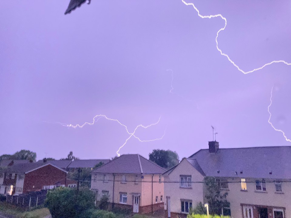
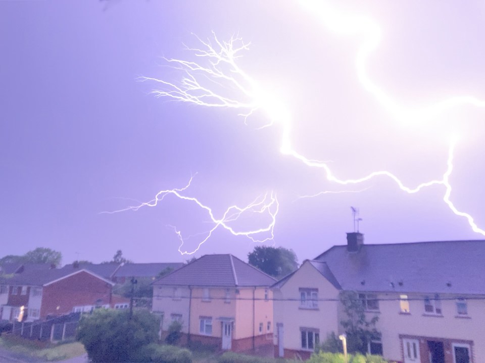
Thunderstorms develop when warm and humid air exists below much colder air in the atmosphere. This destabilises the air, allowing clouds to form and produce heavy rain – and storms.

The thunderstorms will develop initially over northern France but they will be allowed to “grow” as they move north over the eastern half of the UK on Saturday.

After arriving on Friday night, the storm is forecast to move inland, pushing northwards across England on Saturday morning before arriving in Scotland by midday.

On Sunday and Monday, Yellow warnings for rain will cover parts of England and Scotland as residual parts of the storm linger.

Last week’s heatwave brought travel disruption, a number of water-related deaths and hosepipe bans being declared for millions living in Yorkshire, Kent and Sussex.

One might think a heavy dose of rainfall would help reduce these drought conditions – but because the rain will be very heavy in localised areas, it will run off the dry, baked earth rapidly, perhaps overwhelming local sewers and waterways.

A substantial recovery in reservoir and groundwater aquifer levels would require a more sustained spell of wet weather.

Yorkshire’s hosepipe ban is expected to last until winter.

Thunderstorms following a heatwave in the summer of 2022 brought flash flooding to London and the surrounding areas, flooding roads and Tube stations.

The rainfall also caused cancellations and delays at Gatwick Airport.

Source link

Met Office issues fresh thunderstorms warning for this weekend with up to 50mm of rain to hit in hours

THE MET Office has issued a fresh warning for thunderstorms this weekend, with up to 50mm of rain expected to fall in just a few hours.

The alert signals the arrival of severe weather, bringing the risk of flooding, hail, and lightning strikes across the UK.

UK thunderstorm warning map.

4

There is also a follow-up amber warning that continues until 5am on MondayCredit: Met Office
Lightning striking over houses.

4

Lightning strikes in the sky along Church Street in Witham, Essex
Lightning strike over houses.

4

During the thunderstorms, some parts of the UK could receive up to 50mm of rain

Brits are urged to be prepared as intense storms are set to hit several regions, sparking concerns of widespread disruption.

The weather warnings will affect several areas, including London, the South East, and the East of England, until 5am Sunday morning.

There is also a follow-up amber warning that continues until 5am on Monday.

The Met Office has highlighted the risk of “fast flowing or deep floodwater” that could endanger lives, with some communities potentially becoming cut off due to flooding.

During the thunderstorms, some parts of the UK could receive up to 50mm of rain in just a few hours.

This will bring major disruption, including road closures, train cancellations, and power outages.

The Met Office also warned of the potential for strong winds, reaching up to 50mph, which could exacerbate the impact of the storms.

Met Office meteorologist Alex Deakin commented that the day would start off “hot and humid,” with some areas of the country potentially seeing temperatures climb as high as 30°C.

However, conditions will soon change, with thunderstorms beginning around 2pm in Wales and the South West, spreading to other areas later in the day.

Parts of southern England, including London, could see temperatures remain as high as 28°C on Friday evening, though the heat will quickly give way to more unsettled weather.

With 30–50mm of rain expected in some areas before the storms ease early on Saturday, residents across Greater London, Plymouth, Bath, Brighton, Norwich, and parts of the South East are advised to remain alert.

Cardiff and other southern regions could experience the heaviest downpours, with some areas possibly receiving up to 80mm of rain.

This level of rainfall is likely to cause significant surface water flooding, making driving conditions dangerous and leading to the risk of accidents.

The situation has already caused significant flooding in parts of the South West, particularly in Plymouth, where local residents battled knee-deep water.

The storms have already resulted in closures, with some roads, such as Gdynia Way and Kings Street, shut down due to flooding.

The Theatre Royal in Plymouth has also closed its doors as a result of flood damage.

James Mackenzie-Blackman, Chief Executive and Artistic Director of TRP, stated: “The torrential rain has required us to close the Theatre Royal today as we continue to deal with a significant flood into our basement.

Our priority is the safety of our staff, our artists, visitors and participants.”

In addition to the potential flooding, strong winds of up to 50mph are expected to cause problems along coasts and hills, further complicating the situation for drivers and emergency services.

Local authorities have advised caution when travelling, particularly in affected areas, as there may be delays and possible cancellations to train and bus services.

The disruption could continue into the weekend, particularly in areas where floodwater lingers.

The Met Office has issued a warning about the increased risk of power cuts, especially in areas where storms bring lightning strikes.

Residents are urged to be prepared for the possibility of service interruptions, with some homes and businesses potentially losing power due to the extreme weather.

This follows Friday’s amber weather warning for thunderstorms, hail, and lightning strikes.

The public is encouraged to monitor the weather closely and take precautions to protect themselves and their property.

Person walking in heavy rain with an umbrella and a balloon in a plastic bag.

4

Brits are urged to be prepared as intense storms are set to hit several regions, sparking concerns of widespread disruptionCredit: PA

Source link