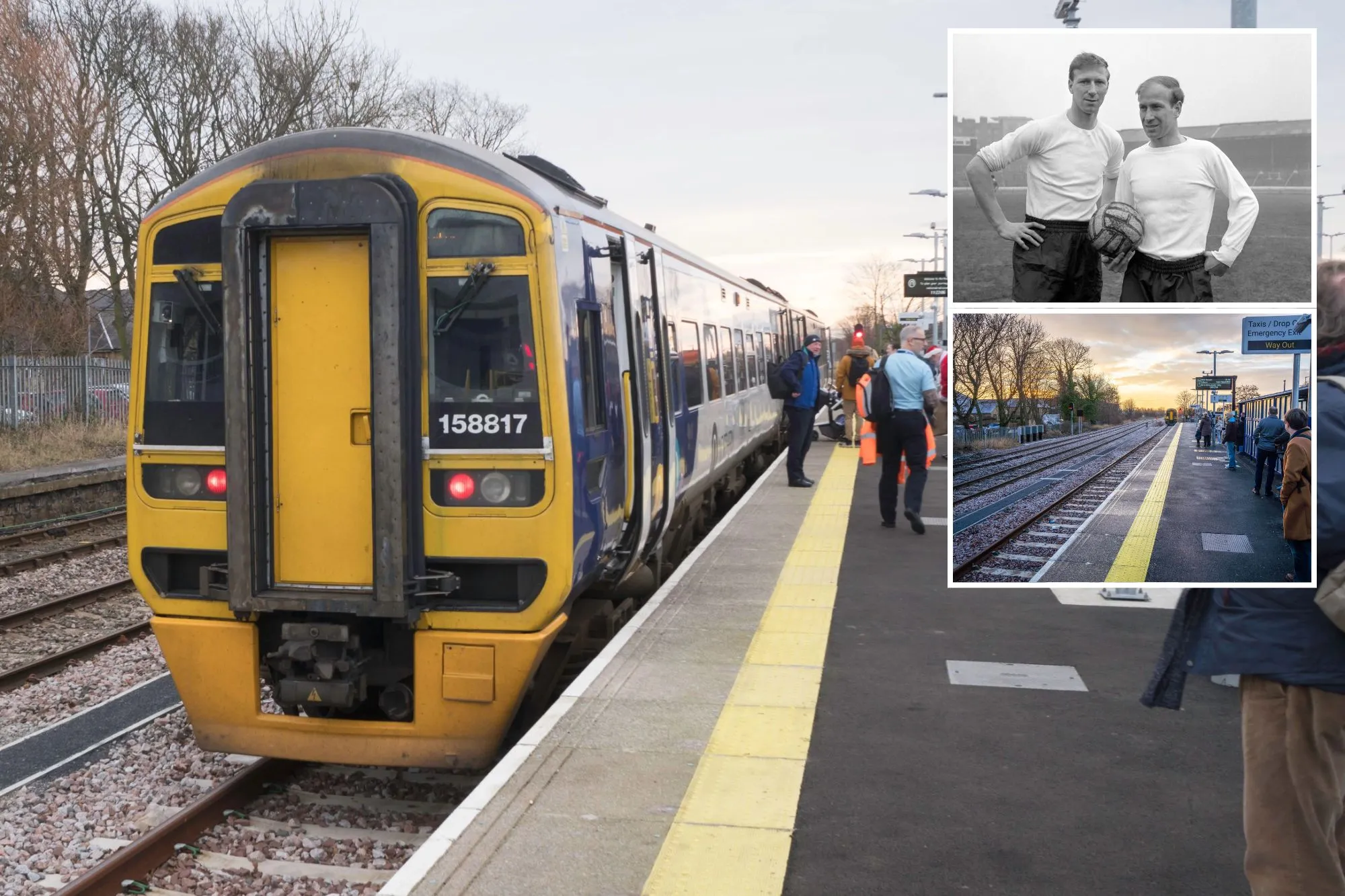
A TINY station in Northumberland that was closed from the 1960s until last year, has been crowned ‘Britain’s most life-changing station.’
It beat 330 stations across the country for the award – known as ‘The World Cup Of Train Stations,’ and the town itself also has a rich celebrity past from sportsmen to actors.
Sign up for the Travel newsletter
Thank you!
Ashington Station is part of the new Northumberland LineCredit: AlamyAshington originally closed in the 1960s and only opened in December 2024Credit: Alamy
‘The World Cup Of Stations’ was launched in honour of 200 years of railways in Britain, to bring attention to the stories behind the stations and how much they’ve changed and brought communities together.
It was shut due to Beeching cuts to the railway in the 1960s which resulted in the closure of thousands of stations, but Ashington has made a mighty comeback.
Ashington competed against 330 nominations, which were whittled down to 20 by a judging panel.
It stood against the likes of Liverpool Lime Street, London Paddington, London Waterloo, Vauxhall and York.
In just over five days, over 24,000 people voted, with Ashington being one of the country’s newest stations in the shortlist.
Trains started running between Newcastle and Ashington in December last year, and it’s not even finished yet as additional stations along the line are set to open next year.
Jacqueline Starr, Rail Delivery Group chief executive officer said: “As we celebrate 200 years of rail history, Ashington shows how investing in stations can transform lives linking people to opportunity, pride, and possibility.”
The Northumberland Line was one of many to be axed as part of the Beeching cuts to the railway in the 1960s but was brought back as part of a £298.5 million redevelopment project.
Ashington sits 15 miles north of Newcastle, close to the coast and was once centre of the coal mining industry.
Jack and Bobby Charleton were both born in AshfordCredit: PARobson Green, star of Grantchester, is from the Northumberland townCredit: Alamy Stock Photo
It was the birthplace of some of Britain’s biggest sporting stars like Bobby and Jack Charlton, who were both part of the England national team that won the 1966 World Cup against West Germany.
Jackie Milburn, also born in Ashington and went on to be one of the most legendary players for Newcastle United.
Cricketing brothers Steve and Ben Harmison were born there, and after retiring from cricket, Steve managed his hometown football club inAshington.
The top things to do in Ashington on Tripadvisor include exploring the Woodhorn Museum which is based on the town’s mining history.
Inside is memorabilia, gallery exhibitions and trinkets from the days it operated as a mining hub.
It’s known for having lots of woodland and green spaces too which you can see by visiting the Queen Elizabeth II Country Park, or taking a walk around the Wansbeck Riverside Park.
On Tuesdays, Ashington holds a market where sellers sell all sorts from food to clothing and gifts.
The town is very close to Newcastle, which is a 30 minute drive away, or along the Northumberland Line, a 48 minute train journey.
Ashington is very near to Newbiggin-by-the-Sea which has three beachesCredit: Alamy Stock PhotoDruridge Bay has a stretching seven-mile long beachCredit: Alamy Stock Photo
It’s not all towns and cities, Ashington is minutes from the coastline with some of the nearest beaches in neighbouring Newbiggin-by-the-Sea.
The small seaside town has a north, south and east beach where you’ll spot a fleet of traditional fishing boats – but the coastline is a great spot for paddling in the summer and rock pooling.
At the seaside town, you can get a bargain ice cream at Caffe Bertorelli and cheap pints at The Coble pub.
Ashington is near Cresswell Beach too, a sandy spot known for being dog-friendly and a starting point for theNorthumberland Coastal Path.
Another great beach is Druridge Bay which has rugged coastline, a seven-mile beach, sand dunes and is popular for activities like birdwatching and horse riding.
These beaches might be about to get even more popular as this year, Northumberland beaches became one of the world’s trending destinations.
The northern county of Northumberland has been getting lots of attention over the summer, with plenty of pretty beaches that are usually less busy than those in the south.
Airbnb said: “Northumberland is drawing more summer visitors, with searches up over 50 per cent this summer, thanks to its pristine North Atlantic beaches.”
These includeEmbleton Bay, Low Newton-by-the-Sea and the seaside town of Bamburgh.
When I heard that Greggs were opening a pub, my first thought was “a Greggs sausage roll and a pint in one place? Sign me up!”
But what I wasn’t expecting to find at The Golden Flake Tavern was a traditional, homely pub with an impressive menu that could take on the best of boozers.
The room was decked out with local art, a jukebox, board games and cosy booths. From branded Golden Flake coasters and napkins, to a framed painting of Geordie legends Ant and Dec.
Newcastle is the birthplace of Greggs, so it’s only fitting that the pub has opened in its city centre.
The Golden Flake Tavern’s menu is loaded with Greggs’ best-loved bakes, reimagined aspub dishes.
I opted for the Greggs pub staple: the Sausage Roll and Mash and was wowed by the dish’s posh presentation. The sausage roll had been sliced in half and carefully propped up against the mash like a Michelin star meal.
I tried the Gosforth 1939 Stottie Lager (£6.50) – abeernamed with Greggs’ history in mind – and all cocktails are priced at £11.50.
The Golden Flake Tavern is open daily from 11am – 7pm at Fenwick Newcastle. And you need to visit soon as the pub is open to visitors until February 2026.
These were the 20 train stations that made the shortlist for the ‘The World Cup Of Train Stations’…
On Friday, I visited an old friend I hadn’t seen in months: the Mt. Baden Powell trail near Wrightwood. I was nervous about what I’d find, given the trail’s proximity to a recent wildfire.
The Bridge fire started near the Bridge to Nowhere trailhead in Angeles National Forest in early September. It charged northward, burning 56,030 acres and destroying 81 structures, including homes in Wrightwood and Mt. Baldy. It also incinerated campgrounds and scorched dozens of miles of trails.
Given the region’s fire-related closures, I hadn’t been back in 9½ months. I drove toward Wrightwood wondering how devastated the landscape would be. Would the trail be well maintained? Would this place where I’ve spent so many hours bounding up the mountainside still be as beautiful as I remembered?
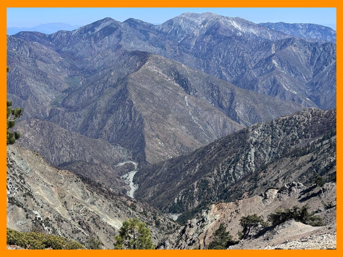
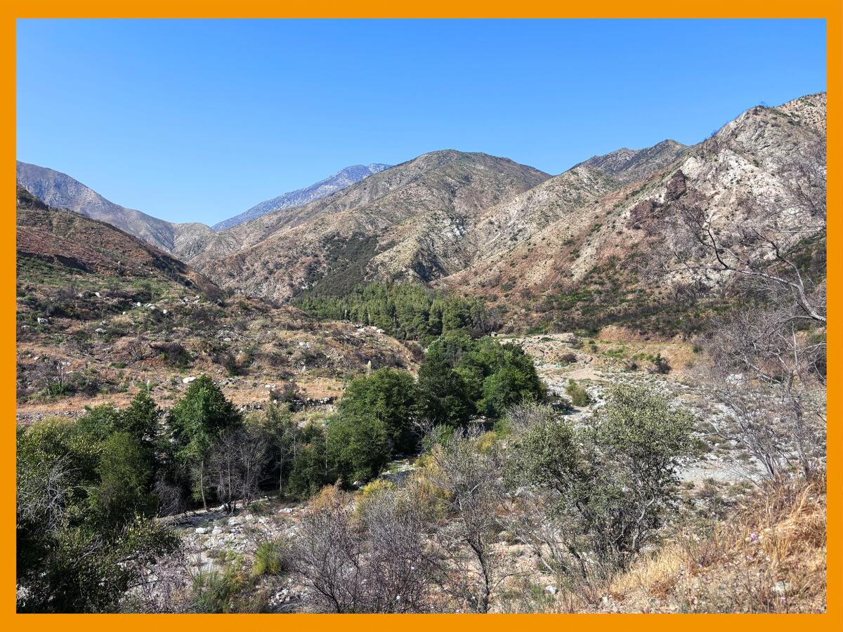
The San Gabriel Mountains as seen from the Mt. Baden Powell trail.
(Jaclyn Cosgrove / Los Angeles Times)
After my eight-mile trek to the summit of Mt. Baden Powell and back, I am relieved to report that it was an awesome day on the mountain — with some caveats.
Newsletter
You are reading The Wild newsletter
Sign up to get expert tips on the best of Southern California’s beaches, trails, parks, deserts, forests and mountains in your inbox every Thursday
You may occasionally receive promotional content from the Los Angeles Times.
The Mt. Baden Powell hike is one of several trails that reopened in late June after Angeles National Forest officials, for reasons that remain unclear, terminated the Bridge fire order.
Just over two weeks after the closure order was canceled, the California Department of Transportation announced that the section of State Route 2 (Angeles Crest Highway) from Big Pines Highway to the gate near Vincent Gulch in Angeles National Forest had reopened to the public.
From the Mt. Baden Powell trail, hikers can see a portion of the Bridge fire burn scar.
(Jaclyn Cosgrove / Los Angeles Times)
This meant hikers could actually park near the trailhead rather than parking five miles away and hoofing it down the highway to reach the Baden Powell starting point. (Note: The section of Angeles Crest Highway between Vincent Gulch and Islip Saddle remains closed but could reopen this fall.)
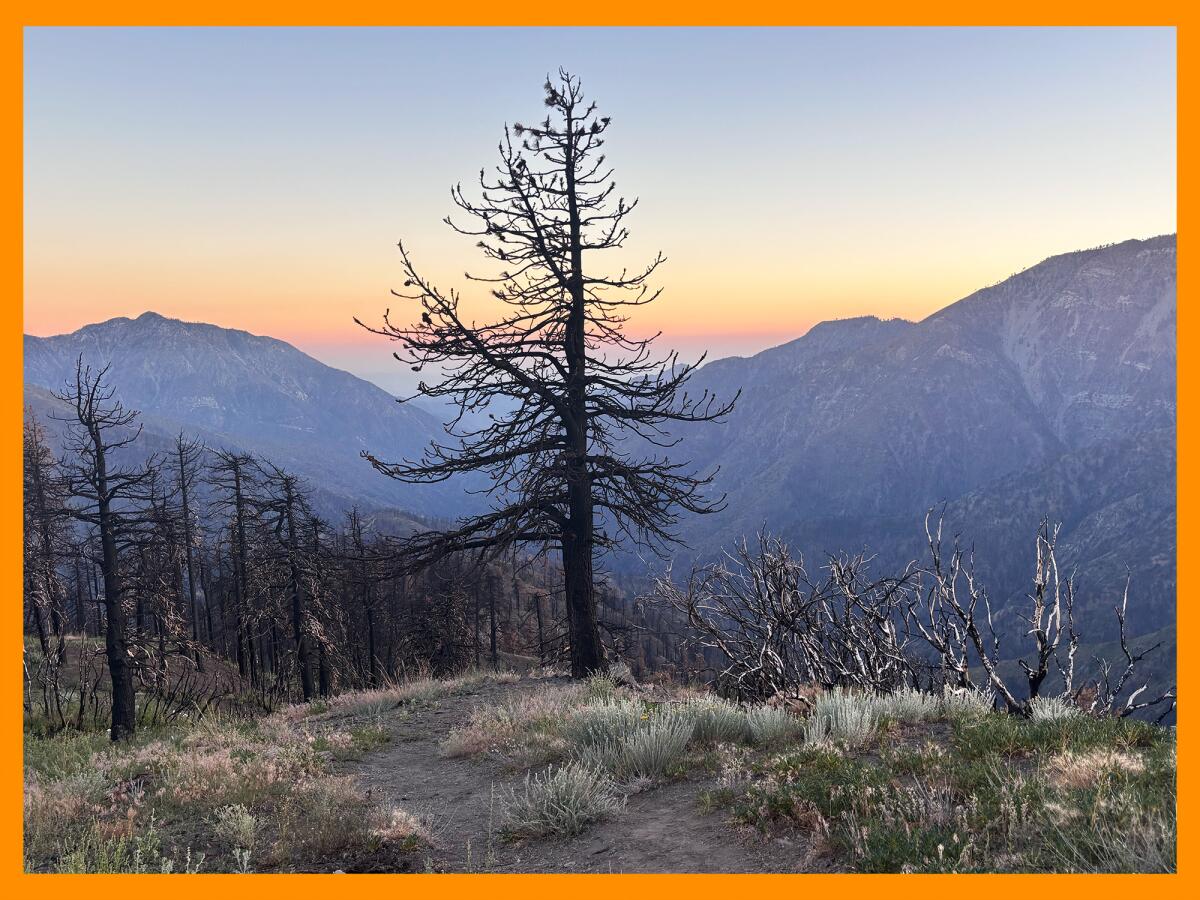
As I drove west out of Wrightwood on Angeles Crest Highway, it was impossible to miss the burned landscape. I stopped at the Inspiration Point vista lookout and the destroyed Grassy Hollow Visitor Center, where blackened trees jut out of the ground like dark skeletal remains.
But pulling into the Vincent Gap parking lot, I was relieved to see green conifers thriving on the mountainsides. I chatted in the parking lot with another hiker who said she’s been coming to Wrightwood since the early 1970s when her grandparents had a home there. She was eager to return after the closure order was lifted but, like me, was nervous to see the fire’s effects.
It was hard to see so many burned and dead trees killed by fire and by drought, she said. She was surprised by how the area around Vincent Gap still looked healthy.
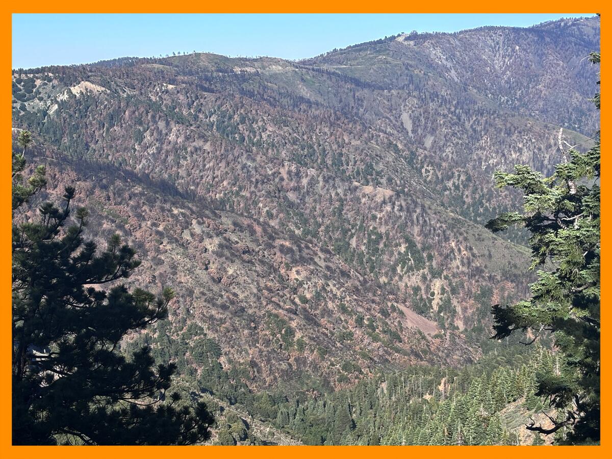
Several burned trees remain in the Bridge fire burn scar near Bear and Vincent gulches around Wrightwood.
(Jaclyn Cosgrove / Los Angeles Times)
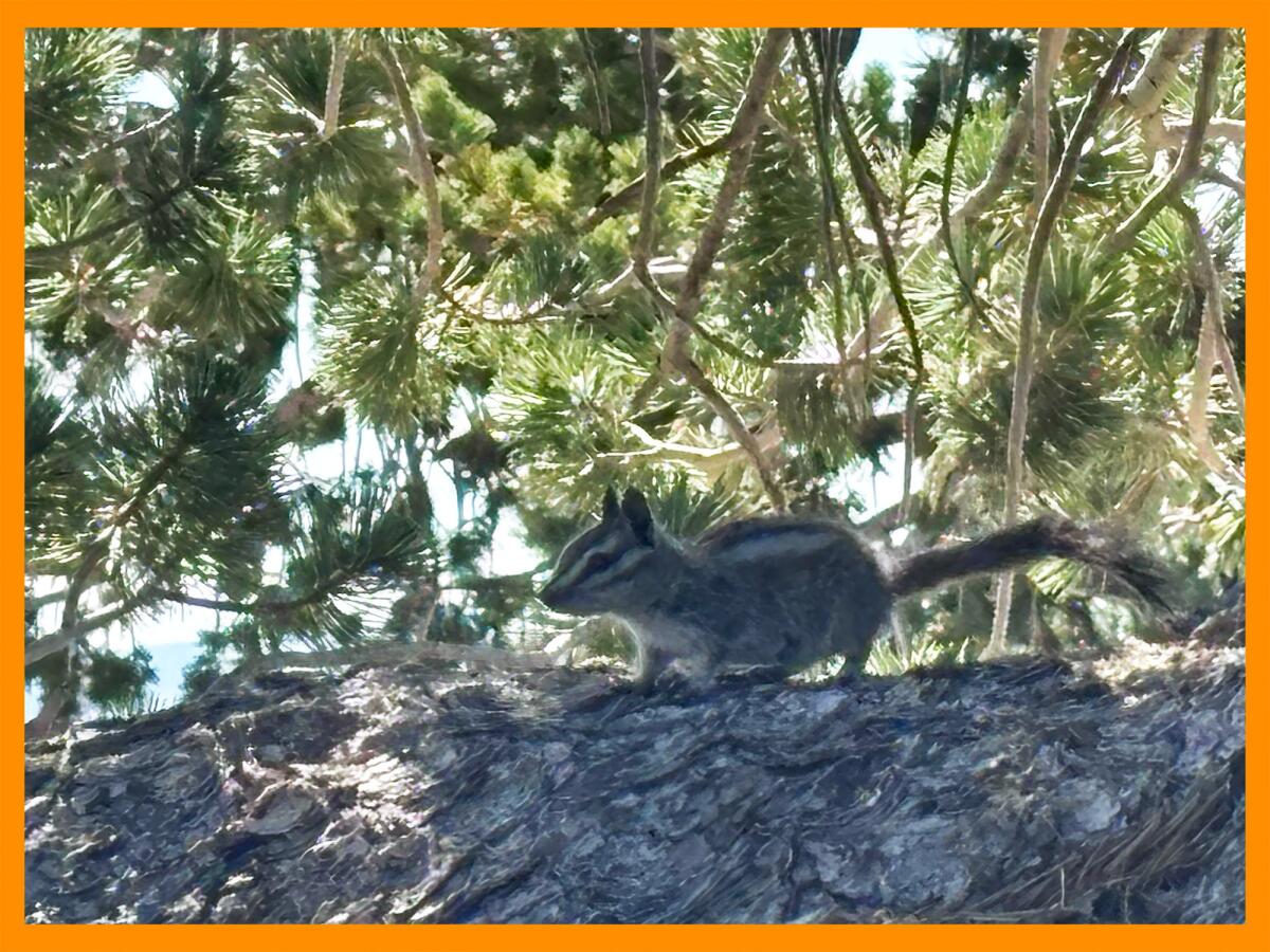
As I started the trail, infamous for its 40(ish) switchbacks, I spotted California sister butterflies as well as chipmunks performing parkour exercises across the trail, trying to remain unseen and looking extremely cute in the process. I listened to the tweets of dark-eyed juncos and the teensy blue-gray gnatcatcher.
About two-thirds of a mile in, I started to take in the views, looking northeast where the fire’s burn scar is easy to track by simply observing the large swaths of brown and dead trees. A begrudgingly optimistic person, I smiled when I saw green cedars and pines still alive among their dying brethren.
I was relieved to see the small wooden bench, just under a mile in, still perched on the mountainside. I yelled at a particular boulder just before Lamel Spring: “I remember you!” Although so much had changed around the trail, so much remained the same.
Chipmunks are easy to spot on the Mt. Baden Powell hike through the San Gabriel Mountains.
(Jaclyn Cosgrove / Los Angeles Times)
At Lamel Spring, I refilled my water bottle and felt grateful at the burst of colors around me — bright orange lichen and wildflowers including small pink roses, scarlet monkey flowers and the rare lemon lily. A mountain chickadee buzzed past my head before landing on a branch nearby, where it kept watching me as I savored the cool spring water. It’s easy to forget that some of these animals are as curious, if not more, of us than we are of them. They people watch too.
I continued my hike and smiled when I saw the large old log on the trail that someone long ago carved “half way” into. It is, indeed, the halfway point.
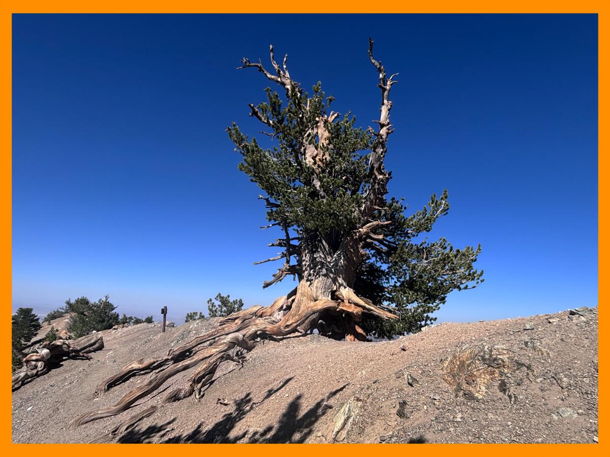
The higher I climbed, the cooler and quieter it got, outside of the ravens squawking to each other from across the mountain. After some light grumbling, as I was ready for lunch, I arrived at the Wally Waldron Tree, a limber pine that might be the oldest living thing in the San Gabriel Mountains. Believed to be 1,500 years old, this tree is thankfully yet another thing that remains unchanged on this trail.
The Wally Waldron Tree remains alive and well, perched on a ledge parallel to the Mt. Baden Powell trail. The tree might be the oldest living thing in the San Gabriel Mountains.
(Jaclyn Cosgrove / Los Angeles Times)
I was the only human on the summit, and I took the opportunity to, for the first time, lie down and enjoy my surroundings. (I did set a timer because I have this nightmare of accidentally falling asleep on the trail!)
Mt. Baden Powell is one of my favorite hikes, in part, because it’s a suffer fest. I have almost given up several times on this hike because it is a challenging slog up the mountain. Outside the trickling spring, there isn’t any water, and it can get hot as you charge up its more exposed switchbacks. But I keep coming back because every single time I reach the top, I am awestruck by the panoramic views of the San Gabriel Mountains, the Antelope Valley and more. It is important to be reminded of the specks of stardust we are sometimes.
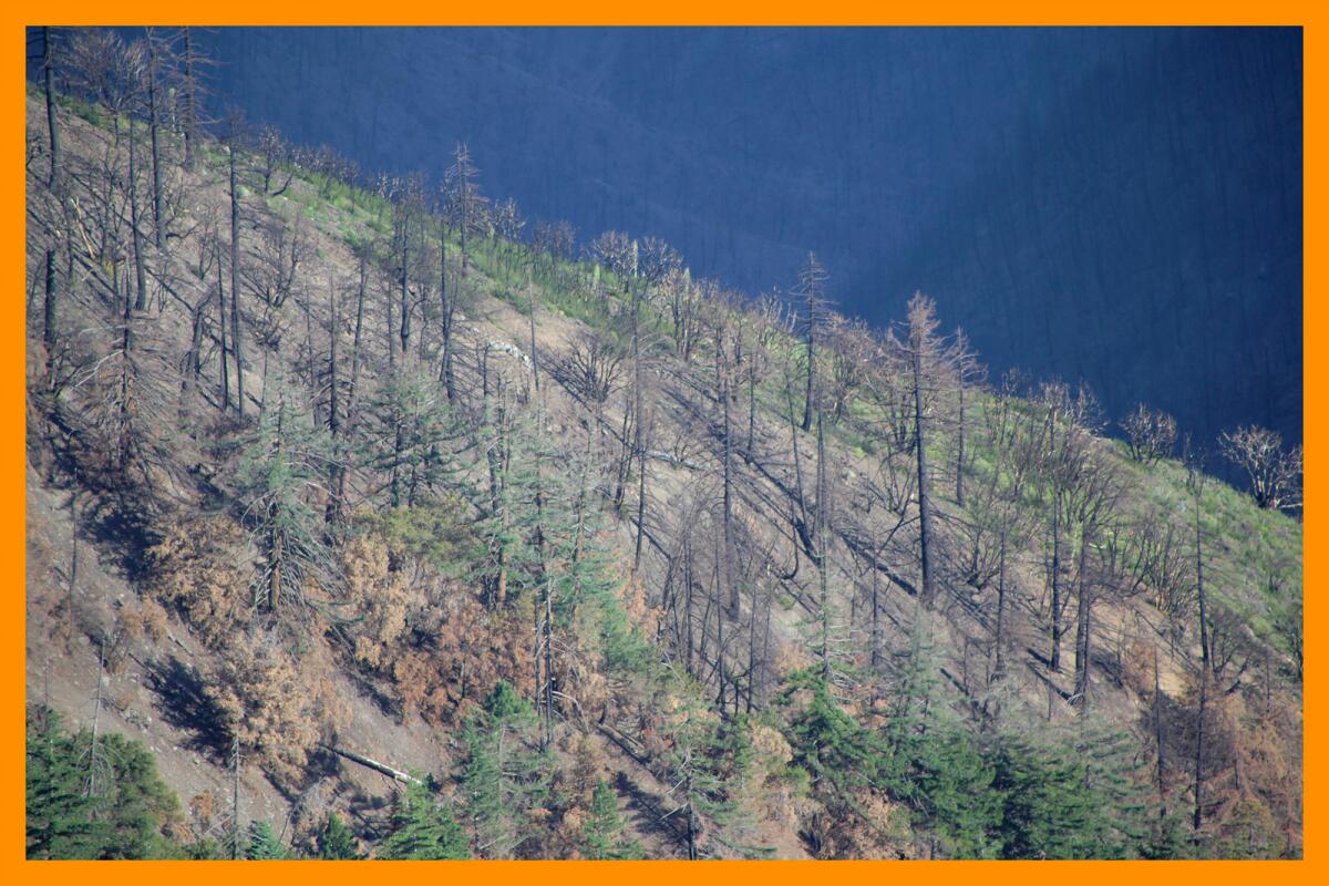
Several burned trees near Inspiration Point near Wrightwood.
(Jaclyn Cosgrove / Los Angeles Times)
This was the first time I’ve hiked Mt. Baden Powell and not seen a single cut-through on the trail, a bad habit of hikers who ignore the switchbacks and charge straight down. The trail was easy to follow and in pristine condition. A forest service worker told me that several volunteers are to thank for that. (Thank you!)
After the hike, I headed west down Big Pines Highway to see how the rest of the region fared in the Bridge fire. The first three-quarters of a mile of the highway are in the burn scar, but as I drove farther west, it became harder to discern where the burn scar was. There was so much green and life around me.
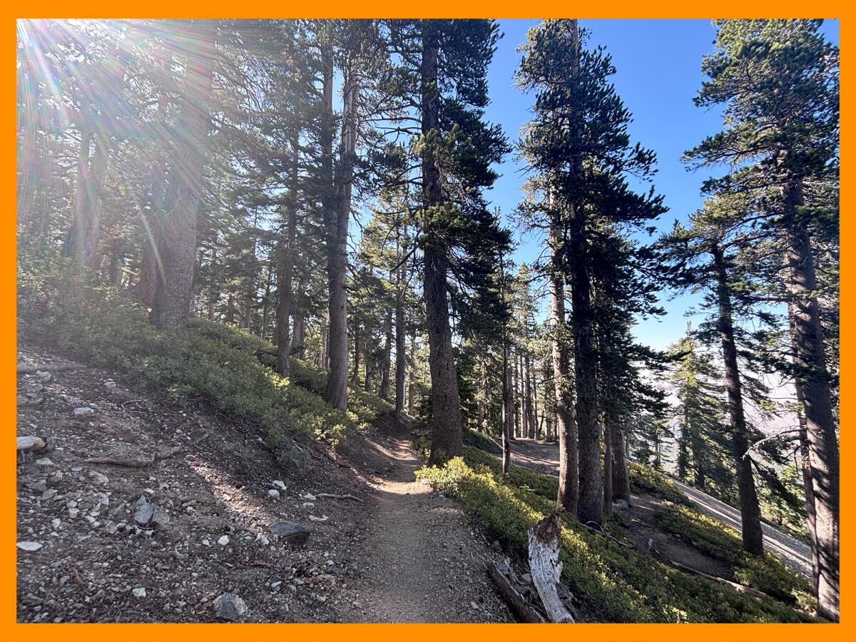
The hike to Mt. Baden Powell was thankfully spared in the Bridge fire and has hundreds of lush green shade trees.
(Jaclyn Cosgrove / Los Angeles Times)
Multiple campgrounds were damaged or destroyed in the fire and remain closed, including Blue Ridge, Guffy and Lupine. But several are open and offer beautiful escapes in the outdoors.
Those sites, which are managed by Mountain High, include:
Appletree: Eight first come, first served walk-in campsites, including three that are ADA accessible; piped water available; vault toilets.
Peavine: Eight first come, first served walk-in tent sites; no potable water; vault toilets.
Lake: Eight sites, including six requiring reservations, next to Jackson Lake; drinking water available; vault toilets.
Mountain Oak: Seventeen sites near Jackson Lake featuring flush toilets and water faucets.
Table Mountain: A large campground featuring more than 100 of both first come, first served and reservation-only sites; drinking water available; vault toilets.
The last place on my list was Jackson Lake, where you can rent kayaks and paddle boats from Mountain High every Thursday through Monday.
Jackson Lake is a popular place near Wrightwood where families enjoy fishing, picnicking and staying at the nearby campground.
(Jaclyn Cosgrove / Los Angeles Times)
Families were picnicking and fishing, including some teenagers standing in the water in waders.
One child, hearing the croak of a local amphibian, shouted to his grandfather about how he was going to catch a frog and have frog legs for dinner that night. Nearby, another youngster had just caught a rainbow trout. She held the fish in her hands, showing an older kid her score.
May they, too, get to visit this area for many years to come.
3 things to do
A cluster of mushrooms in Canyon View Park in Aliso Viejo.
(Jason Armond / Los Angeles Times)
1. Forage for information in Los Feliz 🍄 In collaboration with Friends of Griffith Park, Foraging & Mushroom Hunting Women of SoCal will host a beginner-friendly talk at 6:30 p.m. tonight at the Los Feliz Branch Library (1874 Hillhurst Ave.) on how to find mushrooms in the summer. Bat Vardeh, the foraging group’s founder, will explain how fungi is always growing in the region. Learn more at the group’s Instagram page.
2. Have a fin-tastic time in Long Beach Cal State Long Beach’s Shark Lab will host its free family-friendly Sharks @ the Beach event from 10 a.m. to 3 p.m. Saturday at the CSU Long Beach Hall of Science. Guests can take lab tours, talk with scientists and observe live marine animals. No registration is required. Learn more at the lab’s Instagram page.
3. Help trees recover from wildfire near Malibu The Resource Conservation District of the Santa Monica Mountains needs volunteers from 9 a.m. to noon Saturday to tend to more than 400 oak trees at Trippet Ranch in Topanga State Park. This is the first tree care event in the park since the Palisades fire. Participants will water trees, yank weeds and apply mulch as well as possibly plant new acorns to replace trees that did not thrive. Volunteers will also collect data for a reforestation project, which started in 2018. Participants should bring sun protection and water and wear clothes they don’t mind getting dirty and durable shoes. Register at eventbrite.com.
The must-read
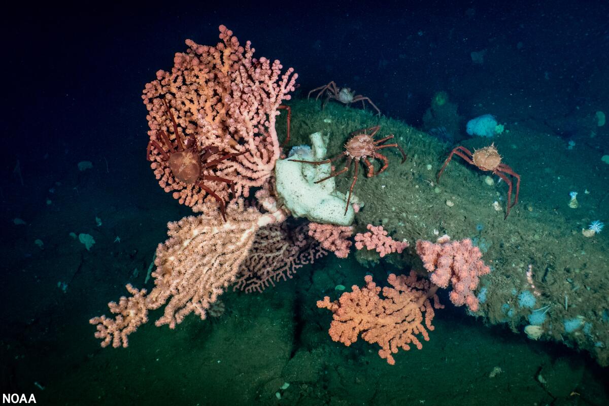
Deepwater bubblegum coral, a host for California king crab, observed during a 2020 exploration of the Santa Lucia Bank off the central coast of California.
(Associated Press)
Despite continued challenges from the federal government, California is moving close to its goal of conserving 30% of lands and coastal waters by 2030. Times staff writer Lila Seidman reports that almost five years after the state launched its 30×30 initiative, California has conserved 26.1% of its lands and 21.9% of its coastal waters — or roughly 41,000 square miles and 1,150 square miles respectively. It’s great news — though it comes with an asterisk. “Federal attacks on public lands and environmental protections … could impact our progress,” California’s Natural Resources Secretary Wade Crowfoot said, “and we could actually see — if these federal attacks are successful — our acreage moving backwards.”
The Times will keep following these stories in The Wild and in stories from our climate team.
Happy adventuring,
P.S.
The REI store in Burbank will host its first community day from 11 a.m. to 3 p.m. Sunday. Guests can snag free milkweed for monarchs from Arroyo Foothills Conservancy, which will teach visitors how to raise the milkweed to support pollinators. Shift Our Ways Collective will hand out pumpkin starters and teach folks how to take care of the seasonal plant. Also, other local groups, including Friends of Griffith Park, CicLAvia, We Explore Earth and Northeast Trees will host additional programming, including screening short films.
For more insider tips on Southern California’s beaches, trails and parks, check out past editions of The Wild. And to view this newsletter in your browser, click here.
I was concerned when I arrived Tuesday to the Bridge to Nowhere trailhead about the conditions I’d find in the canyon.
Last September, the Bridge fire broke out near the trailhead and burned 56,030 acres, destroying 81 structures, flattening campgrounds and scorching many miles of beloved trails.
The area, which sits a short drive northeast of Azusa, had been closed since the fire started Sept. 8 and was expected to remain so through at least May 22, 2026, per the closure order that officials renewed just three weeks ago.
Then, last Friday, officials terminated that closure order “to once again allow the public to access and enjoy their public lands.”
“We understand how important these areas are for recreation, connection, and well-being,” Angeles National Forest spokeswoman Keila Vizcarra told me in an emailed statement.
Newsletter
You are reading The Wild newsletter
Sign up to get expert tips on the best of Southern California’s beaches, trails, parks, deserts, forests and mountains in your inbox every Thursday
You may occasionally receive promotional content from the Los Angeles Times.
That means every trail in the Bridge fire burn scar has reopened to the public, including the Bridge to Nowhere hike and, one of my personal favorites, the Mt. Baden-Powell hike. (You can see a full list here.)
Poking around with my trekking poles last week, I tried to understand this shift in mindset by officials. I asked and have yet to receive an answer regarding their reasoning.
So I was left to ponder a couple of things. First, a closure order usually stays in place for months, if not years, to allow the land to heal and because post-fire hazards need to be remediated before the public returns, a point forest service officials have stressed many times.
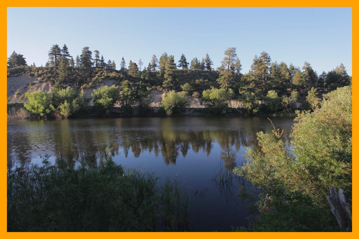
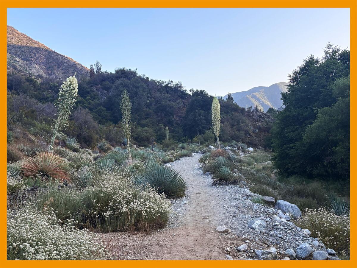
Although the trees and foliage are growing near the East Fork of the San Gabriel River, the mountains around the canyon leading to the Bridge to Nowhere trail are varying levels of bare.
(Jaclyn Cosgrove / Los Angeles Times)
After the Bobcat fire in 2020, the popular Big Santa Anita Canyon area remained closed for four years, reopening after volunteer trail crews spent hundreds of hours repairing the damage to trails from the fire and subsequent flooding. And the Eaton fire closure order is expected to remain in place at least through 2026, maybe even 2027.
Second, I asked Justin Seastrand, forest recreation manager at Angeles National Forest, at a May 22 news conference about the status of the Bridge fire closure order. Many in the hiking community were angry that the order had closed the trails leading to Mt. Baldy, and I wanted to know whether hope was on the horizon.
Seastrand told me that two of the three trails to the top of Mt. Baldy would reopen soon (which they did), but Bear Canyon (sometimes called Old Mt. Baldy Trail) would remain closed. “Most of the remaining trails that were in that original closure are going to stay closed another year,” Seastrand said, adding that doing closures on a year-to-year basis was “standard practice.”
Also, I asked him to clarify whether he had any specific updates on the the East Fork of the San Gabriel River area, including the Bridge to Nowhere trail. Before the Bridge fire, it was one of the most popular swimming areas in the region, visited (and trashed) by thousands.
“That’s going to stay closed again for another year, and possibly longer, because that entire watershed is burned,” Seastrand told me at the May 22 news conference. “That trail is one of the primary dangers I mentioned of being in a canyon bottom subject to flooding and possible debris flows.”
The East Fork of the San Gabriel River northeast of Azusa.
(Jaclyn Cosgrove / Los Angeles Times)
Seastrand said the forest service has several science partners that help the agency monitor watershed response, and “sometimes it recovers quicker than others, but that watershed was severely, severely burned.”
So what gives?
I’m not the only one with questions. A concerned reader emailed me Friday (thank you!) about the sudden termination of the order. Also, on Reddit, the online hiking community quickly spun, somewhat understandably given the lack of clarity from local officials, into conspiracy theories regarding the termination.
“This has the smell of politics attached to it and may be connected to this discussion of selling off public lands. Probably more details will be coming out over the next couple of months,” one Reddit user wrote. (For context on the proposed public land sale, see our Must Read below.)
“Trying to be a bit more optimistic… Maybe they don’t have the staff to enforce these closures? I know I’m reaching here… but like I said, I’m trying to be positive,” another user replied, referencing the Trump administration’s firing of thousands of U.S. Forest Service workers, including in our local Southern California forests.
Western fence lizards and other reptiles are easy to spot as you hike alongside the East Fork of the San Gabriel River.
(Jaclyn Cosgrove / Los Angeles Times)
When I learned the Bridge fire closure order was terminated, my first concern was about trail safety. A wildfire can, and often does, destroy chaparral that grows along steep hillsides. The roots of the manzanita and other trees and shrubs provide stability to steep canyon walls. Given the flooding following the Bridge fire, what types of conditions would hikers face when taking the Bridge to Nowhere trail?
I asked Vizcarra in my email request about whether crews completed any repairs on the 9.5-mile trek to the iconic bridge or any of the other trails in the Bridge fire closure area before the area reopened.
“No restoration work has been completed on the San Gabriel River Trail leading into the Sheep Mountain Wilderness,” Vizcarra said in an email. “Trail maintenance in the Angeles National Forest is largely dependent on dedicated volunteers, and given the vast number of trail miles, not all can be regularly maintained. It may take considerable time for some trails to be fully restored. That said, the Forest Service does not close trails solely due to lack of maintenance, as such closures often lead to off-trail hiking and increased safety risks. Visitors should always exercise caution and be prepared for rugged conditions when exploring public lands.”
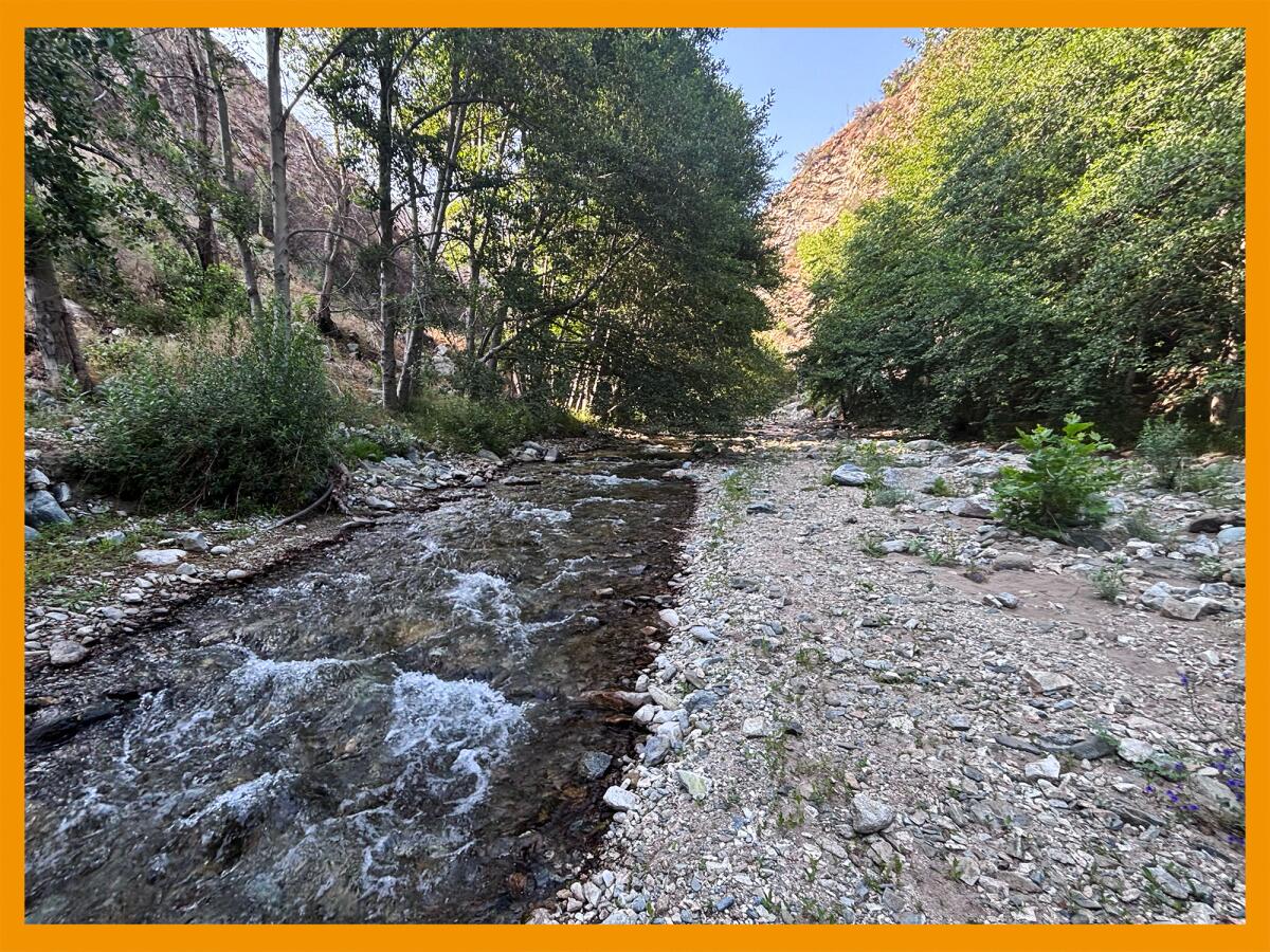
The path to the Bridge to Nowhere trail is lush and healthy near the river.
(Jaclyn Cosgrove / Los Angeles Times)
During my visit Tuesday, I was relieved as I drove along East Fork Road to see several dumpsters and trash cans that hopefully visitors will use when they come to swim and play in the river. In recent years, volunteer groups have repeatedly removed hundreds of pounds of trash from the East Fork area after visitors on busy weekends left it polluted.
Right before the trailhead, I paused at a stoplight, which controls traffic while workers perform construction in the area. Plan accordingly. A sign cautions visitors to expect delays.
I arrived and had been parked two minutes before someone pulled up next to me, asked whether this was the Bridge to Nowhere trailhead and told me they’d gotten lost and hiked in the wrong area (but had fun, nonetheless).
Starting out, I quickly noticed the first of many landslides. They’re not terribly challenging to navigate, at least for now. I spoke to several hikers who made it the 4.75 miles to the bridge, and although they had a great time, they noted the trail looked a lot different because of all the landslides.
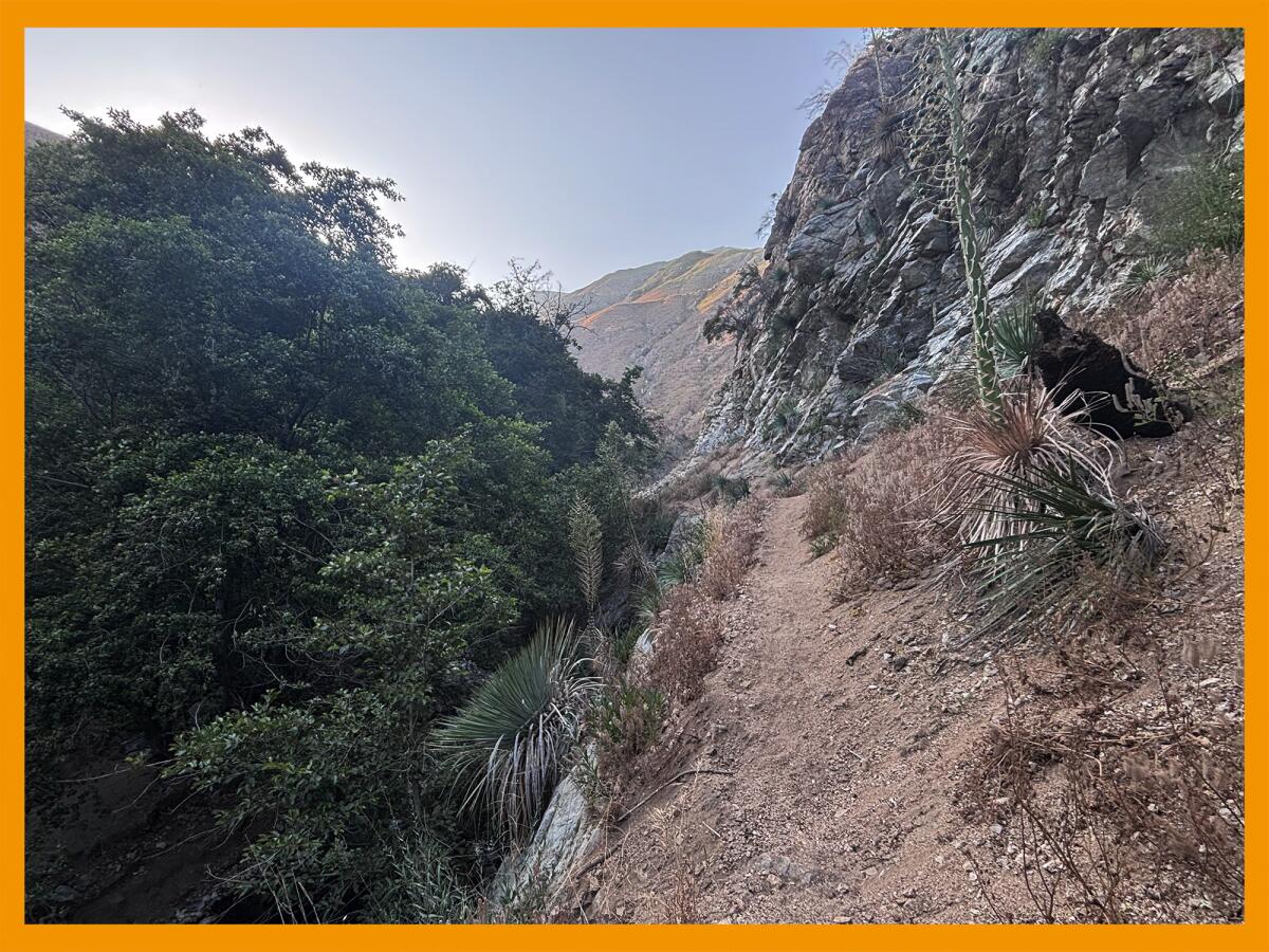
The trail to the Bridge to Nowhere includes taking narrow, sandy paths with steep drop-offs.
(Jaclyn Cosgrove / Los Angeles Times)
This made me wonder: Although the trail is passable now, what will those landslides — which have blasted away parts of the trail — look like after thousands of people clomp over them on their way to the bridge? How will those landslides and surrounding trail fare after the next winter rains wash away more dirt and dead plants?
Just over half a mile in, I arrived at a restroom that a location scout for a horror film would have been delighted to discover. Its floor was caked in mud, and graffiti surrounded an accidentally ironic sign that read, “Please keep restroom clean.”
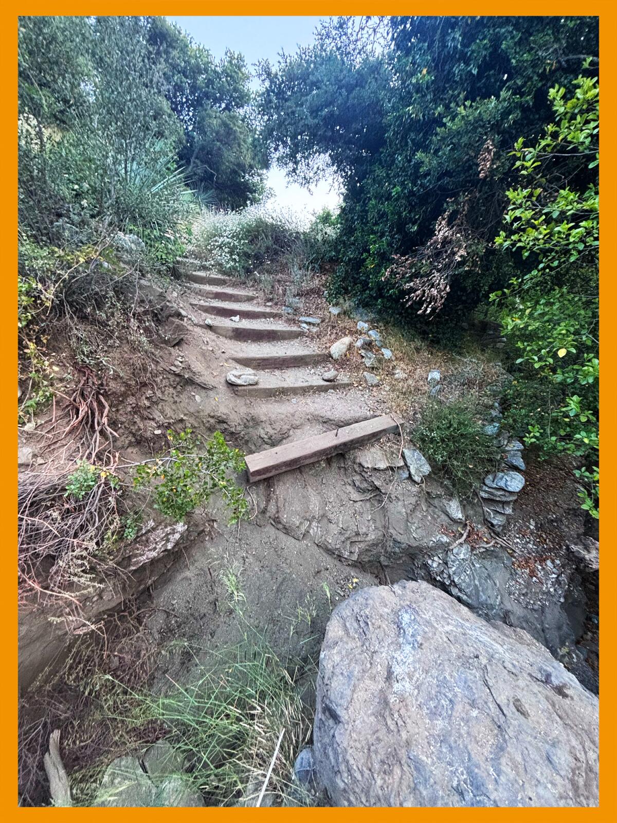
Soon, I arrived at wooden railroad ties that previously served as steps down the path. I am petitioning we rename them the Stairs to Somewhere, because they currently lead down into a ditch where you shouldn’t go. Instead, the trail now jags around them.
On your way to the Bridge to Nowhere, avoid these stairs to somewhere. The trail goes around them, as they lead into a steep drop-off.
(Jaclyn Cosgrove / Los Angeles Times)
Continuing forward, I observed a healthy-looking canyon surrounded by hillsides and mountains that were varying levels of bare. There were leafy green pines and walnut trees near the river and blackened (possibly dead) manzanita and other chaparral up on the mountains.
Overall, I found the trail itself fairly easy to follow as long as I looked at the map I downloaded on my hiking app, comparing the route that it recommended with the official East Fork Trail. I missed a turn a few times, but I faced the same problem the first time I hiked to the Bridge to Nowhere in 2020.
Also, on that trek, I didn’t feel particularly safe in a few spots. I remember navigating a narrow, sandy path high above the canyon floor that felt unstable as I rushed over it. It was one reason — the biggest being the crowds — that I avoided the area, hiking at less crowded parts of the river.
Every hike carries risk. Whenever you enter the backcountry, which includes the Bridge to Nowhere hike, it’s good to remember the hiking adage YOYO, or you’re on your own.
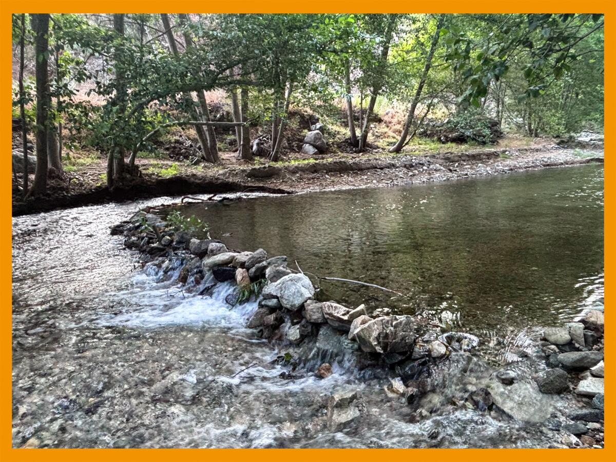
This dam, created using rocks and sticks, is a harmful practice that visitors should refrain from when visiting the San Gabriel River. Damming the river inhibits trout and other animals from moving about their home.
(Jaclyn Cosgrove / Los Angeles Times)
That said, the Bridge to Nowhere hike carries with it some specific risks that I plan to consider when visiting. If your hiking app or map suggests you do something that doesn’t feel safe, reconsider. If your friend thinks you should ford the river, pause and think about it. People have drowned here.
Also, I wouldn’t hike here if the forecast called for rain, as the bare hillsides could be unstable and cause debris flows. And unless a local trail crew adopts this hike and maintains it, it’s important to remember that new hazards could pop up after a wind or rainstorm.
When I mentally put my concerns aside, I did have a fabulous time hiking this trail, and although I remain worried about the long-term effects of thousands of people visiting a trail with several landslides, I found it to be a beautiful and peaceful place as I hiked past pine and walnut trees and small bursts of wildflowers and buckwheat.
On my way out, I texted my friend, excited to return, but I will do so with some caution.
3 things to do
Cyclists peddle through Culver City during a previous Pride ride.
(Karim Sahli)
1. Bike, skate or scoot to Pride in Culver City Culver City Pride will host a 5(ish)-mile bike ride at 4 p.m. from Syd Kronenthal Park in Culver City to the annual Pride festival. Cyclists, skaters and anyone else traveling on wheels can participate and are encouraged to wear rainbow colors. Don’t have a bike? Metro Bike Share will host a 1.4-mile, one-way bike ride to the park, and participants can rent wheels from the agency’s program. Culver City Pride requires helmets for all participants. Riders should also bring sunscreen and a refillable water bottle. Register for the ride at eventbrite.com.
2. Learn about local ecology at Elephant Hill Coyotl + Macehualli and a group of scientists will host a guided ecological walk from 8 a.m. to noon Saturday through Elephant Hill in El Sereno. The event is the launch for long-term, community-led research focused on how to be good stewards of the land and what data are needed to do so. Participants will learn about local birds, insects and plants from scientists, along with field methods in gathering data. Guests should wear sturdy shoes and bring walking sticks, as the group will traverse uneven land. Learn more and register at eventbrite.com.
3. Celebrate the last of Pride season with L.A. County Parks L.A. County Department of Parks and Recreation will host the final week of its Pride Outside events Thursday through Sunday at public spaces across the region. Each event is about two hours and features entertainment, giveaways and information from local nonprofit groups. San Gabriel River Park will host its event from 9 a.m. to noon. Guests can take nature walks and make buttons, among other activities. Vasquez Rocks will have its Pride event from 4 to 7 p.m. Sunday and offer s’mores and more. Learn more at the department’s Instagram page.
The must-read
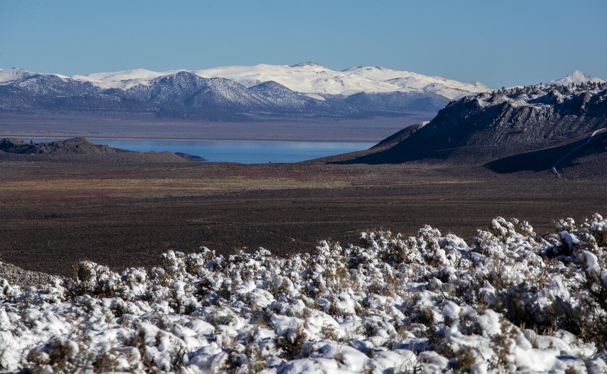
Snow-covered peaks and sagebrush frame a view of Mono Lake in Lee Vining, Calif., in 2021.
(Brian van der Brug / Los Angeles Times)
Last week, news broke that Sen. Mike Lee (R-Utah) had proposed selling up to 3.3 million acres in public lands managed by the U.S. Forest Service and Bureau of Land Management, aiming to allow the land to be developed for affordable housing. Environmental and outdoors advocates were skeptical, fearing it could open public land to a litany of harmful uses. Proponents said the U.S. is protecting way too much land, and the concept would help rural communities. But the proposal was put on ice on Monday after the “Senate parliamentarian — who advises the government body on interpreting procedural rules — determined the proposal didn’t pass muster under the the Byrd Rule, which prevents the inclusion of provisions that are extraneous to the budget in a reconciliation bill,” wrote Times staff writer Lila Seidman. Whether the proposal will be brought back in a different iteration remains to be seen.
Happy adventuring,
P.S.
Facing a significant budget cut, the L.A. County Department of Parks and Recreation is scaling back operations and hours at multiple locations. The county parks department will close six of its regional parks — Castaic Lake, Frank G. Bonelli (already temporarily closed because of a high-voltage transformer failure on May 5), Kenneth Hahn, Peter F. Schabarum, Santa Fe Dam and Whittier Narrows — on Mondays and Tuesdays. It also will shorten the summer pool season and end much of the popular Parks After Dark programming. If you’d like to help the parks in this challenging time, you can volunteer at your favorite park or donate to the parks foundation. You can learn more here.
For more insider tips on Southern California’s beaches, trails and parks, check out past editions of The Wild. And to view this newsletter in your browser, click here.